Music is a very important part of every body's life. For some, the tunes represent the milestones, the places, the times and the significant episodes of their existence. It is also said that music is food for the soul that should profoundly inspire us to greater vision, wherefore we soar with the music as we should ....................Amor Patriae
MUSIC OF MY ERA
Monday, July 4, 2022
HAPPY INDEPENDENCE DAY JULY 4,2022
The Founding Fathers of the United States were directed as well as inspired by God in the creation and writing of the United States Constitution. Over the 220 plus years that the constitution has existed the constitution has undergone many changes. To distinguish the original constitution from the constitution that the United States is governed by today we will call the original document the Founding Fathers Constitution. Yet the SCOTUS FAILED the interpretation of the original constitution by allowing party lines to influence their decisions.
"EQUAL JUSTICE UNDER LAW"-These words, written above the main entrance to the Supreme Court Building, express the ultimate responsibility of the Supreme Court of the United States. The Court is the highest tribunal in the Nation for all cases and controversies arising under the Constitution or the laws of the United States. As the final arbiter of the law, the Court is charged with ensuring the American people the promise of equal justice under law and, thereby, also functions as guardian and interpreter of the Constitution.
The Supreme Court is "distinctly American in concept and function," as Chief Justice Charles Evans Hughes observed. Few other courts in the world have the same authority of constitutional interpretation and none have exercised it for as long or with as much influence. A century and a half ago, the French political observer Alexis de Tocqueville noted the unique position of the Supreme Court in the history of nations and of jurisprudence. "The representative system of government has been adopted in several states of Europe," he remarked, "but I am unaware that any nation of the globe has hitherto organized a judicial power in the same manner as the Americans. . . . A more imposing judicial power was never constituted by any people."
The unique position of the Supreme Court stems, in large part, from the deep commitment of the American people to the Rule of Law and to constitutional government. The United States has demonstrated an unprecedented determination to preserve and protect its written Constitution, thereby providing the American "experiment in democracy" with the oldest written Constitution still in force.
The Constitution of the United States is a carefully balanced document. It is designed to provide for a national government sufficiently strong and flexible to meet the needs of the republic, yet sufficiently limited and just to protect the guaranteed rights of citizens; it permits a balance between society’s need for order and the individual’s right to freedom. To assure these ends, the Framers of the Constitution created three independent and coequal branches of government. That this Constitution has provided continuous democratic government through the periodic stresses of more than two centuries illustrates the genius of the American system of government.
The complex role of the Supreme Court in this system derives from its authority to invalidate legislation or executive actions which, in the Court’s considered judgment, conflict with the Constitution. This power of "judicial review" has given the Court a crucial responsibility in assuring individual rights, as well as in maintaining a "living Constitution" whose broad provisions are continually applied to complicated new situations.
While the function of judicial review is not explicitly provided in the Constitution, it had been anticipated before the adoption of that document. Prior to 1789, state courts had already overturned legislative acts which conflicted with state constitutions. Moreover, many of the Founding Fathers expected the Supreme Court to assume this role in regard to the Constitution; Alexander Hamilton and James Madison, for example, had underlined the importance of judicial review in the Federalist Papers, which urged adoption of the Constitution.
Hamilton had written that through the practice of judicial review the Court ensured that the will of the whole people, as expressed in their Constitution, would be supreme over the will of a legislature, whose statutes might express only the temporary will of part of the people. And Madison had written that constitutional interpretation must be left to the reasoned judgment of independent judges, rather than to the tumult and conflict of the political process. If every constitutional question were to be decided by public political bargaining, Madison argued, the Constitution would be reduced to a battleground of competing factions, political passion and partisan spirit.
Despite this background the Court’s power of judicial review was not confirmed until 1803, when it was invoked by Chief Justice John Marshall in Marbury v. Madison. In this decision, the Chief Justice asserted that the Supreme Court's responsibility to overturn unconstitutional legislation was a necessary consequence of its sworn duty to uphold the Constitution. That oath could not be fulfilled any other way. "It is emphatically the province of the judicial department to say what the law is," he declared.
In retrospect, it is evident that constitutional interpretation and application were made necessary by the very nature of the Constitution. The Founding Fathers had wisely worded that document in rather general terms leaving it open to future elaboration to meet changing conditions. As Chief Justice Marshall noted in McCulloch v. Maryland, a constitution that attempted to detail every aspect of its own application "would partake of the prolixity of a legal code, and could scarcely be embraced by the human mind. . . . Its nature, therefore, requires that only its great outlines should be marked, its important objects designated, and the minor ingredients which compose those objects be deduced from the nature of the objects themselves."
The Constitution limits the Court to dealing with "Cases" and "Controversies." John Jay, the first Chief Justice, clarified this restraint early in the Court’s history by declining to advise President George Washington on the constitutional implications of a proposed foreign policy decision. The Court does not give advisory opinions; rather, its function is limited only to deciding specific cases.
The Justices must exercise considerable discretion in deciding which cases to hear, since approximately 7,000-8,000 civil and criminal cases are filed in the Supreme Court each year from the various state and federal courts. The Supreme Court also has "original jurisdiction" in a very small number of cases arising out of disputes between States or between a State and the Federal Government.
When the Supreme Court rules on a constitutional issue, that judgment is virtually final; its decisions can be altered only by the rarely used procedure of constitutional amendment or by a new ruling of the Court. However, when the Court interprets a statute, new legislative action can be taken.
Chief Justice Marshall expressed the challenge which the Supreme Court faces in maintaining free government by noting: "We must never forget that it is a constitution we are expounding . . . intended to endure for ages to come, and consequently, to be adapted to the various crises of human affairs."
The U. S. Founding Fathers were provided with a unique perspective that few people in history have experienced firsthand that is living under both extremes of government rule. The authority of a tyrannical government as well as living under an ineffectual government charter with insufficient powers to govern. Initially life under the King George III of England was acceptable. In fact, most of the people enjoyed life under the authority of the King of England. As time passed grievances arose that the King was unable or unwilling to address. The King’s unwillingness to correct the problems encountered by the colonists mounted till corrections had to be made. The King refusing to address the problems worsened the situation for the colonists by adding additional laws, tariffs and taxes onto the backs of the colonists. A once loved King George III became a tyrannical leader. The U. S. Founding Fathers attempted to redress the situation through every legal avenue they had available. This eventually led to a hardening of positions on both sides which in turn led to the Revolutionary War.
Life under an Ineffective Government Charter
The colonies after cutting ties with England established a charter the Articles of Confederation to administer the duties, obligations of the thirteen colonies as well as conducting the war. The Articles of Confederation were found to be ineffective not providing sufficient authority to the central government. The Articles of Confederation were dependent upon the colonies relinquishing authority over their territory. The colonists as well as their colonial governments were unwilling to give the central government sufficient authority to effectively govern the thirteen colonies. In spite of these deficiencies the Colonists were able to win the Revolutionary War. George Washington credited the colonies performance in the war to acts of Providence. The colonists lived several years under the limited authority of the central government governing using the Articles of Confederation charter. This allowed the colonists to understand the disadvantages of life under a government that did not possess sufficient authority to effectively rule. Living under these two extremes the Founding Fathers knew the disadvantages of both governmental entities. The Founding Fathers historical experience allowed them to create a comprehensive document designed to protect the rights of the people.
The Founding Father’s Constitution
Life under the rule of the King taught the colonists to fear absolute control. Whereas life under the charter of the Articles of Confederation taught the Founders that a central government must have certain powers and authority to be able to govern properly. Faced with these two opposing positions the U. S. Founding Fathers undertook the creation of the United States Constitution.
Checks and Balances
The Founders were fearful that a central government over time would increase its authority and control over the people established sets of checks and balances to limit the ability of the central government to morph into a tyrannical government without the approval of the States and the people. To protect the rights and freedom of the people checks and balances were established. Thomas Jefferson believed that the government at the State level, being closer to the people, would provide the people with greater representation. By balancing the authority of the national government with the combined powers of the States the powers of the national government are limited. In this manner the powers of the Federal government are balanced between the States and the Federal or central government. Though the power of the Federal government was now balanced the Founding Fathers were still fearful that the central government could still develop into a tyrannical government body. Further checks were established to limit and restrict the ability of the central government from acquiring additional authority and power over the people. Among the checks three entities of the national government established branches with specific duties and responsibilities. Each branch had VETO authority over the other branches. The bi-camel congress was given separate distinct responsibilities. A bi-camel congress was established to represent their segment of the controlling government bodies. The Senate was to defend the State’s rights whereas the House of Representatives were to represent the people. It is this VETO authority that provides the checks to an out-of-control Federal government.
States Rights
The Federal government’s authority and powers are derived directly from the States. The States were placed between the Federal government and the people. In this way the States are a “Wall of Political Protection” protecting the rights and freedom of the people. To accomplish this control authority the States were provided with Senators that would be under direct control of their State legislature. The U. S. Senators were to report directly to their State legislature to determine the response the Senators should or should not take at the Federal level of government. The U. S. Senators were appointed by their States legislature. The Senators were subject to the dictates of their particular State’s legislature. In this way the States could protect the States authority as well as protect the freedom of its citizenry from infringing power of the Federal government. The House of Representatives was established to represent and protect the people of their state. The House Representatives were elected by their state’s registered voters. The House Representatives served subject to the dictates of the people.
Founding Fathers
The Founding Fathers established the separation of powers along with the redundancy of checks and balances so that the unalienable rights and freedom of the people could be adequately protected. The Founders were so fearful of the possibility that the central government would morph over time to become tyrannical that the Bill of Rights was added to the Founding Fathers constitution. The Bill of Rights established the specific restrictions dictating the limits that were to be placed on the Federal government. It was only with the addition of the Bill of Rights to the constitution that all the Founders got on board willing to accept the Founding Fathers constitution as the official governing document. The Founders constitution was completed in 1787 and enacted in into the law of the land in 1789.
Strategy Details War Plan to stop Russia and China
Image: AP
NATO was facing rebukes from Moscow and Beijing on Thursday after it declared Russia a “direct threat” and said China posed “serious challenges ” to global stability.
The Western military alliance was wrapping up a summit in Madrid, where it issued a stark warning that the world has been plunged into a dangerous phase of big-power competition and myriad threats, from cyberattacks to climate change.
NATO leaders also formally invited Finland and Sweden to join the alliance, after overcoming opposition from Turkey. If the Nordic nations' accession is approved by the 30 member nations, it will give NATO a new 800-mile (1,300 kilometer) border with Russia.
Russian President Vladimir Putin warned he would respond in kind if the Nordic nations allowed NATO troops and military infrastructure onto their territory. He said Russia will have to “create the same threats for the territory from which threats against us are created.” China accused the alliance of “maliciously attacking and smearing” the country. Its mission to the European Union said NATO “claims that other countries pose challenges, but it is NATO that is creating problems around the world.” Secretary-General Jens Stoltenberg told the summit that Russia's invasion of Ukraine had brought “the biggest overhaul of our collective defense since the end of the Cold War.” The invasion shattered Europe's peace, and in response NATO has poured troops and weapons into eastern Europe on a scale unseen in decades. Member nations have given Ukraine billions in military and civilian aid to strengthen its resistance.
Ukrainian President Volodymyr Zelenskyy, who addressed the summit by video link, asked for more. He urged NATO to send modern artillery systems and other weapons and warned the leaders they either had to provide Kyiv with the help it needed or “face a delayed war between Russia and yourself.” “The question is, who's next? Moldova? Or the Baltics? Or Poland? The answer is: all of them,” he said.
At the summit, NATO leaders agreed to dramatically scale up military force along the alliance's eastern flank, where countries from Romania to the Baltic states worry about Russia's future plans.
It announced plans to increase almost eightfold the size of the alliance's rapid reaction force, from 40,000 to 300,000 troops, by next year. The troops will be based in their home nations but dedicated to specific countries in the east, where the alliance plans to build up stocks of equipment and ammunition.
President Joe Biden, whose country provides the bulk of NATO's firepower, announced a hefty boost in America's military presence in Europe, including a permanent U.S. base in Poland, two more Navy destroyers based in Rota, Spain, and two more F35 squadrons to the U.K.
The expansion will keep 100,000 troops in Europe for the foreseeable future, up from 80,000 before the war in Ukraine began.
Biden said Putin had believed NATO members would splinter after he invaded Ukraine, but he got the opposite response.
“Putin was looking for the Finland-ization of Europe,” Biden said. “You're gonna get the NATO-ization of Europe. And that's exactly what he didn't want, but exactly what needs to be done to guarantee security for Europe.” Still, strains among NATO allies have also emerged as the cost of energy and other essential goods has skyrocketed, partly because of the war and tough Western sanctions on Russia. There also are tensions over how the war will end and what, if any, concessions Ukraine should make.
Money remains a sensitive issue — just nine of NATO's 30 members currently meet the organization's target of spending 2% of gross domestic product on defense.
At what Stoltenberg called a “transformative” summit, the leaders published NATO's new Strategic Concept, its once-a-decade set of priorities and goals.
The last such document, in 2010, called Russia a “strategic partner.” Now, NATO is accusing Russia of using “coercion, subversion, aggression and annexation” to extend its reach.
The 2010 document made no mention of China, but the new one addressed Bejing's growing economic and military reach.
“China is not our adversary, but we must be clear-eyed about the serious challenges it represents,” Stoltenberg said on Wednesday.
NATO said that China “strives to subvert the rules-based international order, including in the space, cyber and maritime domains” and warned of its close ties with Moscow.
The alliance said, however, that it remained “open to constructive engagement” with Beijing.
China shot back that NATO was a source of instability and vowed to defend its interests.
“Since NATO positions China as a systemic challenge,' we have to pay close attention and respond in a coordinated way. When it comes to acts that undermine China's interests, we will make firm and strong responses,” its statement said.
NATO also stressed the need to address political instability in Africa's Sahel region and the Middle East — aggravated by “climate change, fragile institutions, health emergencies and food insecurity” — that is driving large numbers of migrants toward Europe. Host Spain and other European countries pushed for this new focus.
NATO is putting Russia and any other “nuclear-armed peer-competitors” on notice that the trans-Atlantic alliance can and will retaliate against any nuclear attack.
The latest edition of the security bloc’s guiding strategic concept evinces a more muscular posture regarding NATO’s nuclear forces than the 2010 document, which characterized Russia as a “partner” just four years before the Kremlin seized Crimea from Ukraine. And the latest document implies that as North Atlantic allies send a stronger signal about threats from Russia’s nuclear threats, they also won’t fail to keep an eye on China’s nuclear arsenal.
“We have a wartime strategic concept, actually, not a peacetime one, so [we] want to use stronger language,” a senior European official told the Washington Examiner.
The balance of nuclear military power emerged as a burning issue in the last several months, as Russian President Vladimir Putin has invoked Moscow’s arsenal to deter at least some Western support or intervention for Ukraine. His nuclear saber-rattling has spurred some European officials to wonder if Putin thinks he could win a limited nuclear war; the allies, for their part, asserted such a conflict would be a losing proposition for their enemies.
“The circumstances in which NATO might have to use nuclear weapons are extremely remote,” the Strategic Concept reads. “Any employment of nuclear weapons against NATO would fundamentally alter the nature of a conflict. The Alliance has the capabilities and resolve to impose costs on an adversary that would be unacceptable and far outweigh the benefits that any adversary could hope to achieve.”
That’s a more forceful warning than the analogous section of the 2010 document, in which the alliance emphasized that "circumstances in which any use of nuclear weapons might have to be contemplated are extremely remote.” The revision also placed more emphasis on France and the United Kingdom’s nuclear weapons in an apparent effort to signal that the threat of nuclear retaliation for a Russian nuclear attack wouldn’t depend solely on an American president.
"The independent strategic nuclear forces of the United Kingdom and France have a deterrent role of their own and contribute significantly to the overall security of the Alliance,” the 2022 document now reads. “These Allies’ separate centers of decision-making contribute to deterrence by complicating the calculations of potential adversaries.”
The new document also shows more fundamental shifts in the strategic outlook of the allies. In 2010, NATO leaders could agree that “the alliance does not consider any country to be its adversary” and identified “the proliferation of ballistic missiles” as the most salient “real and growing threat to the Euro-Atlantic area” — an apparent reference to Iran’s non-nuclear military capabilities.
Where the arms control section of the 2010 concept could thus declare that "NATO seeks its security at the lowest possible level of [nuclear] forces,” now the allies see a need to deter multiple nuclear powers.
“We will individually and collectively deliver the full range of forces, capabilities, plans, resources, assets and infrastructure needed for deterrence and defense, including for high-intensity, multi-domain warfighting against nuclear-armed peer-competitors,” the new document reads.
The allies made their misgivings about Beijing’s nuclear weapons explicit elsewhere in this year's concept document. “The PRC is rapidly expanding its nuclear arsenal and is developing increasingly sophisticated delivery systems, without increasing transparency or engaging in good faith in arms control or risk reduction,” NATO said.
The U.S. Navy, Marine Corps, and Coast Guard have released a new, overarching tri-service strategy document for how they plan to project maritime power together going forward. The document focuses heavily on how the three services expect to fight on the high seas and adjacent areas on land. However, there is also a very important underlying discussion about adopting a more assertive approach to responding to day-to-day challenges, especially from China, and to a lesser extent, Russia, among other potential adversaries, that are short of a shooting war.
The three services unveiled their new "integrated" strategy, titled "Advantage at Sea: Prevailing with Integrated All-Domain Naval Power," on Dec. 17, 2020. The document includes discussions about of a number of concepts of operation that the trio has been openly discussing, such as a greater focus on distributed operations leveraging a dramatically reorganized Marine Corps riding on smaller amphibious warfare ships, the increased use of unmanned aircraft and naval platforms, and distributed sensor and communications networks. There is also a "renewed emphasis on fighting for and gaining sea control" in light of growing concerns about a potential higher-end future naval fight with a major adversary, such as China or Russia.
In consultation with the intelligence community, U.S. military planners identify events that should be used for planning the size and mix of U.S. forces. There is a tension, however, between planning for the most likely situations as opposed to worst-case events. For example, large-scale, high-intensity conflicts like China invading Taiwan or Russia invading Latvia would be challenging for U.S. and allied militaries but are less likely compared to scenarios such as protracted gray-zone confrontations between China or Russia and their neighbors. U.S. planners usually choose high-intensity scenarios, although protracted conflicts may be harder for the U.S. military to address.
After the scenario subjects are decided, planners build a detailed description of the events leading up to the conflict, the expected actions of adversary, allied, and noncombatant governments and militaries, and the order of battle expected to be employed by each participating nation. Scenarios usually do not detail U.S. government or military actions.
Explain the conceptual framework in designing scenarios for non-conventional conflict.
Non-conventional conflicts are those that do not involve sustained combat between regular armed forces. Examples include insurgencies by militia forces being supported by a state aggressor, such as in Ukraine; harassment of opposing government and commercial activities in international airspace or waters, as in the East and South China Seas; or a de facto blockade of a disputed territory using militia, law enforcement, and civilian forces like that around the Senkaku Islands.
The U.S. Department of Defense (DoD) plans for these events, but they are low priority. However, because they are less intense than traditional scenarios like invasions, non-conventional confrontations can be sustained longer by the aggressor and employ a wide range of proxy, civilian, and paramilitary forces that create challenges for the U.S. military. The predominance of large, highly capable units in U.S. forces makes protracted campaigns potentially unaffordable and reduces U.S. options at lower levels of escalation. As a result, the U.S. government can be portrayed as the aggressor in a non-conventional conflict because the forces it employs are disproportionate for the situation.Identify fundamental assumptions about how the U.S. might engage in conventional and non-conventional contest with China or Russia and explain how these assumptions should be tested in scenario risk analysis.
The DoD has evolved a strong set of assumptions regarding conventional conflicts. The U.S. military generally assumes it will not be the aggressor and will have some, potentially short, warning that will allow the mobilization of forces to the conflict area. Forces already deployed respond to aggression and attempt to delay or deny the enemy’s success while preparing for the arrival of additional forces from adjacent theaters or the continental United States.
The U.S. military has a less coherent view regarding non-conventional conflict. Because these scenarios occur below the level of armed combat, U.S. military forces are often not an appropriate response, but the U.S. government does not continuously deploy law enforcement forces like the Coast Guard or paramilitary units like contractors – although Coast Guard deployments to the Western Pacific are rising. The use of conventional forces is episodic and limited to shows of force, exercises, or freedom of navigation operations rather than directly countering the non-conventional aggression.
What are key challenges and opportunities for U.S. military planners in preparing for potential military confrontation involving China or Russia?
China and Russia are difficult to plan against because they pose multidimensional challenges in areas close to their own territory. Both countries established extensive sensor networks using radar, electronic intelligence, and space imagery around their territory that can be used for surveillance and targeting of a large inventory and variety of precision ballistic and cruise missiles. Their sensor and weapon networks give China and Russia the ability to conduct rapid, large-scale attacks in regions they have interests such as the East and South China Seas for China and Eastern Europe for Russia.
In a conventional conflict, Chinese or Russian missiles give their militaries the ability to delay U.S. reinforcements while quickly attacking U.S. allies to coerce them into submission. In a non-conventional conflict, China and Russia can threaten U.S. military forces and force U.S. commanders to either send in small units at high risk or employ larger units that can defend themselves but are disproportionate for the non-conventional confrontation. As evidenced by the success of Chinese or Russian gray-zone operations over the last decade, the U.S. government has not determined a satisfactory non-conventional response.
How should the new U.S. administration align defense spending allocation with emerging non-conventional threats?
The U.S. government will need a larger number of units that are smaller and less expensive to buy and maintain compared to today’s U.S. military. Less heavily-armed units such as Littoral Combat Ships, Coast Guard cutters, or company-size National Guard formations would be more proportional in non-conventional confrontations against Russian-supported proxy forces or People’s Armed Forces Maritime Militia ships. These units would also be affordable enough to buy and operate in large enough numbers so they can sustain a robust presence in contested areas for a protracted periods.
Top US military commanders explained the new tactics to Congress in March in a series of budget hearings. The commandant of the US Marine Corps, Gen. David Berger, told the Senate Armed Services Committee on March 5 that small units of Marines armed with precision missiles could assist the US Navy to gain control of the seas, particularly in the Western Pacific.
"The Tomahawk missile is one of the tools that is going to allow us to do that," he said.
The Tomahawk — which first gained fame when launched in massed strikes during the 1991 Gulf War — has been carried on US warships and used to attack land targets in recent decades. The Marines would test fire the cruise missile through 2022 with the aim of making it operational the following year, top Pentagon commanders testified.
At first, a relatively small number of land-based cruise missiles will not change the balance of power. But such a shift would send a strong political signal that Washington is preparing to compete with China's massive arsenal, according to senior US and other Western strategists.
Guided missile cruiser USS Cape St. George launches a Tomahawk Land Attack Missile in the eastern Mediterranean Sea, March 23, 2003. US Navy/Intelligence Specialist 1st Class Kenneth Moll
Longer term, bigger numbers of these weapons combined with similar Japanese and Taiwanese missiles would pose a serious threat to Chinese forces, they say. The biggest immediate threat to the PLA comes from new, long-range anti-ship missiles now entering service with US Navy and Air Force strike aircraft.
"The Americans are coming back strongly," said Ross Babbage, a former senior Australian government defense official and now a non-resident fellow at the Washington-based Center for Strategic and Budgetary Assessments, a security research group. "By 2024 or 2025 there is a serious risk for the PLA that their military developments will be obsolete."
A Chinese military spokesman, Senior Col. Wu Qian, warned last October that Beijing would "not stand by" if Washington deployed land-based, long-range missiles in the Asia-Pacific region. China's foreign ministry accused the United States of sticking "to its Cold War mentality" and "constantly increasing military deployment" in the region.
"Recently, the United States has gotten worse, stepping up its pursuit of a so-called 'Indo-Pacific strategy' that seeks to deploy new weapons, including ground-launched intermediate-range missiles, in the Asia-Pacific region," the ministry said in a statement to Reuters. "China firmly opposes that." US military unshackled Royal Australian Navy guided-missile frigate HMAS Parramatta, left, with US Navy amphibious assault ship USS America, Ticonderoga-class guided-missile cruiser USS Bunker Hill, and Arleigh-Burke-class guided-missile destroyer USS Barry in the South China Sea, April 18, 2020. US Navy/MCS 3rd Class Nicholas Huynh via REUTERS
While the coronavirus pandemic rages, Beijing has increased its military pressure on Taiwan and exercises in the South China Sea.
In a show of strength, on April 11 the Chinese aircraft carrier Liaoning led a flotilla of five other warships into the Western Pacific through the Miyako Strait to the northeast of Taiwan, according to Taiwan's Defense Ministry. On April 12, the Chinese warships exercised in waters east and south of Taiwan, the ministry said.
Meanwhile, the US Navy was forced to tie up the aircraft carrier USS Theodore Roosevelt at Guam while it battles to contain a coronavirus outbreak among the crew of the giant warship. However, the US Navy managed to maintain a powerful presence off the Chinese coast.
The guided-missile destroyer USS Barry passed through the Taiwan Strait twice in April. And the amphibious assault ship USS America last month exercised in the East China Sea and South China Sea, the US Indo-Pacific Command said.
In a series last year, Reuters reported that while the US was distracted by almost two decades of war in the Middle East and Afghanistan, the PLA had built a missile force designed to attack the aircraft carriers, other surface warships and network of bases that form the backbone of American power in Asia. Over that period, Chinese shipyards built the world's biggest navy, which is now capable of dominating the country's coastal waters and keeping US forces at bay.
The series also revealed that in most categories, China's missiles now rival or outperform counterparts in the armories of the US alliance. A float carrying a portrait of Chinese President Xi Jinping in Tiananmen Square during the parade marking the 70th founding anniversary of People's Republic of China, on its National Day in Beijing, October 1, 2019. REUTERS/Thomas Peter
China derived an advantage because it was not party to a Cold War-era treaty — the Intermediate-Range Nuclear Forces Treaty (INF) — that banned the United States and Russia from possessing ground-launched ballistic and cruise missiles with ranges from 500 kilometers to 5,500 kilometers. Unrestrained by the INF pact, China has deployed about 2,000 of these weapons, according to US and other Western estimates.
While building up its missile forces on land, the PLA also fitted powerful, long-range anti-ship missiles to its warships and strike aircraft.
This accumulated firepower has shifted the regional balance of power in China's favor. The United States, long the dominant military power in Asia, can no longer be confident of victory in a military clash in waters off the Chinese coast, according to senior retired US military officers.
But the decision by President Donald Trump last year to exit the INF treaty has given American military planners new leeway. Almost immediately after withdrawing from the pact on August 2, the administration signaled it would respond to China's missile force. The next day, US Secretary for Defense Mark Esper said he would like to see ground-based missiles deployed in Asia within months, but he acknowledged it would take longer.
Later that month, the Pentagon tested a ground-launched Tomahawk cruise missile. In December, it tested a ground-launched ballistic missile. The INF treaty banned such ground-launched weapons, and thus both tests would have been forbidden.
The Defense Department tests a conventionally configured ground-launched cruise missile at San Nicolas Island, California, August 18, 2019. DoD photo by Scott Howe
A senior Marines commander, Lt. Gen. Eric Smith, told the Senate Armed Services Committee on March 11 that the Pentagon leadership had instructed the Marines to field a ground-launched cruise missile "very quickly."
The budget documents show that the Marines have requested $125 million to buy 48 Tomahawk missiles from next year. The Tomahawk has a range of 1,600km, according to its manufacturer, Raytheon Company.
Smith said the cruise missile may not ultimately prove to be the most suitable weapon for the Marines. "It may be a little too heavy for us," he told the Senate Armed Services Committee, but experience gained from the tests could be transferred to the army.
Smith also said the Marines had successfully tested a new shorter-range anti-ship weapon, the Naval Strike Missile, from a ground launcher and would conduct another test in June. He said if that test was successful, the Marines intended to order 36 of these missiles in 2022.
The US Army is also testing a new long-range, land-based missile that can target warships. This missile would have been prohibited under the INF treaty.
The Marine Corps said in a statement it was evaluating the Naval Strike Missile to target ships and the Tomahawk for attacking targets on land. Eventually, the Marines aimed to field a system "that could engage long-range moving targets either on land or sea," the statement said.
The Defense Department also has research underway on new, long-range strike weapons, with a budget request of $3.2 billion for hypersonic technology, mostly for missiles.
China's foreign ministry drew a distinction between the PLA's arsenal of missiles and the planned US deployment.
It said China's missiles were "located in its territory, especially short and medium-range missiles, which cannot reach the mainland of the United States. This is fundamentally different from the US, which is vigorously pushing forward deployment." Bottling up China's navy Liaoning, China's first aircraft carrier REUTERS/Bobby Yip
Military strategists James Holmes and Toshi Yoshihara suggested almost a decade ago that the first island chain was a natural barrier that could be exploited by the American military to counter the Chinese naval build-up. Ground-based anti-ship missiles could command key passages through the island chain into the Western Pacific as part of a strategy to keep the rapidly expanding Chinese navy bottled up, they suggested.
In embracing this strategy, Washington is attempting to turn Chinese tactics back on the PLA. Senior US commanders have warned that China's land-based cruise and ballistic missiles would make it difficult for US and allied navies to operate near China's coastal waters.
But deploying ground-based US and allied missiles in the island chain would pose a similar threat to Chinese warships — to vessels operating in the South China Sea, East China Sea and Yellow Sea, or ships attempting to break out into the Western Pacific. Japan and Taiwan have already deployed ground-based anti-ship missiles for this purpose.
"We need to be able to plug up the straits," said Holmes, a professor at the US Naval War College. "We can, in effect, ask them if they want Taiwan or the Senkakus badly enough to see their economy and armed forces cut off from the Western Pacific and Indian Ocean. In all likelihood the answer will be no."
Holmes was referring to the uninhabited group of isles in the East China Sea — known as the Senkaku islands in Japan and the Diaoyu islands in China — that are claimed by both Tokyo and Beijing. The approximate boundaries of the first and second island chains in the western Pacific. US Defense Department
The United States faces challenges in plugging the first island chain. Philippines President Rodrigo Duterte's decision to distance himself from the United States and forge closer ties with China is a potential obstacle to American plans. US forces could face barriers to operating from strategically important islands in the Philippines archipelago after Duterte in February scrapped a key security agreement with Washington.
And if US forces do deploy in the first island chain with anti-ship missiles, some US strategists believe this won't be decisive, as the Marines would be vulnerable to strikes from the Chinese military.
The United States has other counterweights. The firepower of long-range US Air Force bombers could pose a bigger threat to Chinese forces than the Marines, the strategists said. Particularly effective, they said, could be the stealthy B-21 bomber, which is due to enter service in the middle of this decade, armed with long-range missiles.
The Pentagon is already moving to boost the firepower of its existing strike aircraft in Asia. US Navy Super Hornet jets and Air Force B-1 bombers are now being armed with early deliveries of Lockheed Martin's new Long Range Anti-Ship Missile, according to the budget request documents.
The new missile is being deployed in response to an "urgent operational need" for the US Pacific Command, the documents explain.
The new missile carries a 450 kilogram warhead and is capable of "semi-autonomous" targeting, giving it some ability to steer itself, according to the budget request. Details of the stealthy cruise missile's range are classified. But US and other Western military officials estimate it can strike targets at distances greater than 800 kilometers.
The budget documents show the Pentagon is seeking $224 million to order another 53 of these missiles in 2021. The US Navy and Air Force expect to have more than 400 of them in service by 2025, according to orders projected in the documents. An Air Force B1-B Lancer bomber launches a Long Range Anti-Ship Missile during flight testing in August 2013. U.S. Navy
This new anti-ship missile is derived from an existing Lockheed long-range, land attack weapon, the Joint Air-to-Surface Standoff Missile. The Pentagon is asking for $577 million next year to order another 400 of these land-attack missiles.
"The US and allied focus on long-range land-attack and anti-ship cruise missiles was the quickest way to rebuild long-range conventional firepower in the Western Pacific region," said Robert Haddick, a former US Marine Corps officer and now a visiting senior fellow at the Mitchell Institute for Aerospace Studies based in Arlington, Virginia.
For the US Navy in Asia, Super Hornet jets operating from aircraft carriers and armed with the new anti-ship missile would deliver a major boost in firepower while allowing the expensive warships to operate further away from potential threats, US and other Western military officials say.
Current and retired US Navy officers have been urging the Pentagon to equip American warships with longer-range anti-ship missiles that would allow them to compete with the latest, heavily armed Chinese cruisers, destroyers and frigates. Lockheed has said it successfully test-fired one of the new Long Range Anti-Ship Missiles from the type of launcher used on US and allied warships.
Haddick, one of the first to draw attention to China's firepower advantage in his 2014 book, "Fire on the Water," said the threat from Chinese missiles had galvanized the Pentagon with new strategic thinking and budgets now directed at preparing for high-technology conflict with powerful nations like China.
Haddick said the new missiles were critical to the defensive plans of America and its allies in the Western Pacific. The gap won't close immediately, but firepower would gradually improve, Haddick said.
"This is especially true during the next half-decade and more, as successor hypersonic and other classified munition designs complete their long periods of development, testing, production, and deployment," he said.
Wednesday, June 29, 2022
A BOY’S MEMORIES OF MANILA
Manila Chinatown
Prior to the arrival of the Spaniards in 1571, trade between ethnic Filipino Malays and Chinese traders was already established in pre-colonial Manila. Manila's Chinatown is one of the oldest in Asia, established sometime in the late 17th century. It is home to many ethnic Chinese who left the Chinese mainland for a home in the Philippines. Binondo is a stone's throw away from the District of Intramuros, which was the Philippine's administrative capital under Spanish rule. The district was within the range of Intramuros' canons to quell any uprising the Chinese could have started. Binondo became a center of commerce during the American colonial era of the Philippines, since the Chinese were known to be experts in trading and finance. Banks, department stores, restaurants, insurance companies, nearly all giant commercial establishments were built in Binondo, the most prominent of which are located in the Escolta Avenue, though these are somewhat out of vogue and dilapidated today. World War II destroyed much of Binondo's commercial establishments. After the war, most companies relocated to Makati, the current central business district of Metro Manila.
Taal Volcano Left Photo
The Jones Bridge, initially named as the Puente Grande and later known as Puente de España, crosses the Pasig River and connects the districts of the Binondo, Chinatown and Escolta areas with the center of downtown Manila. This bridge is considered to be the oldest in all of the Philippines.
calesa terminal. Kalesa (sometimes called a karitela) is a horse-driven carriage used in the Philippines. The word predates the Spanish conquest and descends ultimately from an Old Church Slavonic word meaning "wheels." This was one of the modes of transportation introduced in the Philippines in the 18th century.
Manila Yacht Club, Roxas Boulevard across the Blvd. was our old quarters at the Manila Naval Station (MNS)
My early recollection of the Legislative, Post office and the fortification near the Pasig River deserved some mention. Along these walls of Fort Santiago were a lot of Cogon grass that we use to clean and cut back in the mid 1950 as a civic duty and as a project for my cub scout den, designated then as Pack Number 1. During World War II, Fort Santiago was captured by the Japanese Imperial Army, and used its prisons and dungeons including the storage cells and gunpowder magazines for hundreds of prisoners who were killed near the end of the war.
Philippine Military Academy, Fort del Pilar, Baguio City.
PMA was modeled after the United States Military Academy with officers from the Philippine Scouts and regularUnited States Army as instructors and members of the general staff.With the outbreak of World War II, training was disrupted at the PMA with Classes 1942 and 1943 being graduated prematurely and assigned to combat units in Bataan and other parts of the country. Many of these young officers perished in the war.After the war, the Academy was reopened on May 5, 1947, at Camp Henry T. Allen in Baguio City. But due to its increasing need for larger grounds, it was soon moved to its present location at Fort Gen Gregorio H Del Pilar, Loakan, some ten kilometers from downtown Baguio. During the 1960s, as a need for more well-rounded individuals was found to be desirable, socio-humanistic courses were added to the school's curriculum.
In the old days the walls were used as security and protection. Threats of invasion by Chinese, Japanese, Dutch and Portuguese pirates prompted the construction of defenses consisting of high stones walls, bulwarks and moats. The walls stretch to 4.5 kilometers in length, enclosing a pentagonal area aprrox. 64 hectares. The area consisted of residences, churches, palaces, schools and govt. buildings. Entry was made possible through gates w/ drawbridges, which were closed before midnite and opened at the break of dawn.
Del Pilar Shrine Marcelo H. Del Pilar Shrine in Bulakan, Bulacan.
Gen. Gregorio Del Pilar Shrine
View from Old Intramuros prior to reconstruction, towards the Post Office Building and Santa Cruz Bridge from the ruins of Recolectos Church 1950s. Notice the grass and vegetation along the walls that we in our young days have to cut and clean.
gregorio del pilar monument
When the National Defense Act was approved on December 21, 1935, the Philippine Constabulary Academy was renamed Philippine Military Academy and was permitted to grant its graduates Bachelor of Science degrees after completion of their four-year curriculum.
My early socialization with non relatives of my age started within the elementary School from Grade 1 to 7. It was 1950, 5 years after the war, when I started schooling. The limited amount of classroom space was clearly evident then for the newly established Parochial School. It did not bother me about the location, maybe of my innocence about the specter of death, as we have our class inside the catacombs at the basement of Espirito Santo Church. I can recall the names of my favorite girl classmates, just like yesterday. To me, they seem to be much nicer, more intelligent than what I feel about the boys. My early perceptions of the bullies in the class, that they were probably motivated by competition for attention, and reminder of who rules among the boys. Those who feel superior though, was never given any quarter, as I have that early sense of justice given to the underdog. So it follows in the years, how many scraps I have to go thru. This is the same all through High School. It is also a lesson to know about myself, as my motivation to study depends on who my teacher was. The more attractive she was the more studious I became.
What I remember about Espiritu Santo Parochial School: it was formally established in 1947 by Rev. Fr. William J. Duschak, SVD, former Vicar Apostolic of Calapan, Oriental Mindoro. Initially, classes were held in the parish hall. Due to the unprecedented increase in student enrolment, the high school department, the Annex 1 and the Annex II buildings were constructed in succession. The following years, Fr. Antonio Albrecht, SVD, the Holy Spirit Sisters and the Secular Clergy efficiently administered the operation of the school. In 1973, the Religious Missionaries of St. Dominic took over its management.
Our song…… E.S.P.S. all praise to thee Glad the song we raise to thee. Down the years we’ll love thy name. Thy renown we’ll all acclaim. Thy love and truth will ever be Stars to guide our loyalty A light to shine . . . . on life’s high sea Alma Mater ESPS. Sons and daughters sing to thee, Worthy gifts we bring to thee. Hearts we give thee loyal truth To those rare gifts we owe to you.
1960: I became aware of my heritage in my junior year at UP Prep and began preparation for my appointment as a cadet of the PMA at Fort Del Pilar. This was a period in my teen years that I remember fondly, memories in my High School, of the hectic days, dashing thru the corridors catching my schedule of classes at Rizal Hall. I recall my bag loaded with books, eager, wide eyed, and quick to learn the tenets of math, the arts and sciences. I remember past friends and stormy situations that most teenagers weathered through. As in life surviving the unspoken pecking order among bigger classmates and the so called in crowd was the rule. That lone wolf streak that kept me apart, which peers seemed to see as a weakness was a measure of heritage that set me off from the current teenage precepts of the day. Later, being a late bloomer, when of age and after further studies, scholarships for a Masters in Civil Enginering at a California State U, having ever spurred curiosity, whetted my appetite for a life of adventure, of soldiering and foreign lands.
Quezon Memorial Circle Elliptical Road Quezon City, Manila
Dr. Jose Rizal Memorial
Paco Park and Cemetery Paco, Manila
Andres Bonifacio EDSA cor. Rizal Avenue Caloocan, Manila
Andres Bonifacio's monument in Caloocan City, Andrés Bonifacio was one of the chief leaders of the revolution of the Philippines against Spanish colonial rule. The 1896 Philippine Revolution was the first revolution in Asia against European colonial rule.
Dugo sa Magdalena. Kinalugmukan ng duguang katawan ni Emilio Jacinto sa simbahan ng Magdalena, Laguna
Mabini monument.This is Apolinario Mabini's monument located at the plaza fronting the city hall. Mabini, tagged as the "Sublime Paralytic", is a son of Tanauan.
In my days we just call this place as Luneta. Manila is the site of the country's premiere park, Rizal Park, which was erected for the country's national hero, José Rizal. Besides having parks and green areas, Manila is the home to several plazas, such as the Plaza Balagtas and Plaza Miranda, the site of the1971 politics-related bombings. Within Manila lies notable parks and green areas, such as the Cultural Center of the Philippines, the Rajah Sulayman Park, Manila Boardwalk, Liwasang Bonifacio, Mehan Garden, Paco Park, Remedios Circle, the Manila Zoological and Botanical Garden, Pandacan Linear Park, and the Malacañang Garden.
National Press Club
Legaspi Urdaneta Monument right photo
Intramuros – Manila This was the place where as a child, I watched young men in fatigues with rifles. Later in college, I would be here, ROTC drills right there at the back of San Ignacio Church ....beside Ateneo ....on the Western side of Sta Lucia
Rojas Civilian Shipyard -1956-photo Located on Sangley Point Navy Base, in background, looking across Canacao Bay is the Philippine Navy Base
In anticipation of hostilities with Spain, then Assistant Secretary of the NavyTheodore Roosevelt ordered the U.S. Asiatic Fleet, under the command of CommodoreGeorge Dewey aboard the USS Olympia, to proceed to the British Crown Colony of Hong Kong. There he was to make preparations to move on the Spanish Fleet in the Philippines, believed to be anchored at Subic Bay. After war with Spain had broken out following the explosion of the USS Maine in Havana, Dewey proceeded to the Philippines and arrived at Subic Bay just before sunset on April 30, 1898. However, Spanish naval authorities had determined that their position there was undefendable and had moved the fleet to Manila Bay.
Under cover of darkness, Dewey proceeded to Manila Bay, arriving just off Corregidor after 11 PM. The ships stealthily moved past the south side of the island fortress, through Boca Grande, and into Manila Bay.
Shortly after midnight they had nearly passed unnoticed when soot in the USS McCulloch's smokestack caught fire, revealing the squadron's position. Spanish batteries on the south shore near Punta Restinga and on El Fraile Island opened fire on the shadowy ships. A few rounds were fired in response by the USS Raleigh. One shell scored a direct hit on El Fraile battery. The Spanish guns then fell silent after firing only three rounds. However, the big guns on Corregidor remained silent. Although concerned that his presence had been revealed, Dewey proceeded slowly eastward toward Manila.
Dawn was beginning to break on the morning of May 1 as the squadron arrived at Manila. At first, however, lookouts posted high on the American ships could not locate the enemy fleet. Then, off to the right, they spotted a number of white buildings on the narrow strip of land known as Sangley Point, and beyond them a line of dark gray objects on the water. A hard turn to starboard brought the American squadron to bear on the Spanish fleet. The Spanish ships were anchored in an arch stretching eastward and southward from the mouth of Cañacao Bay near the tip of Sangley Point. As they approached, the column of American ships, with Olympia at the head of the line followed byBaltimore, Raleigh, Petrel, Concord, and Boston, gradually turned to starboard, bringing their port guns to bear on the Spanish fleet. Dewey turned to Captain Charles V. Gridley, commanding officer of Olympia, and said, "You may fire when ready, Gridley." At 5:41 AM, the squadron opened fire. The Battle of Manila Bay had begun.
The firing became incessant, the white smoke of gunfire becoming so thick that it was difficult to gauge accuracy or effectiveness. Although trapped in the narrow confines of Cañacao Bay, the Spanish fleet managed to maintain a heavy barrage of return fire.
However, most of the Spanish gunfire fell short of its mark. After making five passes in front of the enemy fleet, Dewey withdrew at 7:35 AM to investigate reports that he was low on ammunition. He passed the word that the men should take advantage of the break to eat breakfast. One gunner, eager to return to action, yelled out, "For God's sake, Captain. Don't let us stop now! To hell with breakfast!"
Just after 11:00 AM, after determining that the report of low ammunition was in error and that his ships had suffered little or no battle damage, Dewey re-engaged the enemy. However, this time he met very little resistance. As the smoke cleared, the devastation inflicted by American guns became clearly evident. With the exception of a few gunboats, the Spanish fleet had been totally annihilated. More than 300 Spanish sailors had been killed or wounded. The lone American casualty was due to heatstroke. By 12:30 PM, the Spanish colors over the arsenal at Sangley Point were replaced by a white flag. The Battle of Manila Bay was over. The following day, the naval facilities at Cavite and Sangley Point were officially taken over by U.S. Naval Expeditionary Forces under the command of Commodore George Dewey.
Early in December 1970, it was officially announced that U.S. Naval Station Sangley Point would be closed. On July 1, 1971, Sangley Point changed status from active to inactive in preparation for the turnover of the facility to the government of the Philippines. The Sangley Point Closure Detail was activated under the command of an Officer-In-Charge, CAPT Waldo Atkins, with a 95-man, 7-officer contingent.
In the extremely compressed 60-day period of deactivation, in excess of 350 items of automotive and construction equipment were transferred; more than 400 industrial buildings and government quarters were stripped of furnishings; installed equipment was disconnected and readied for shipment, and all buildings were secured.
Approximately 300,000 pounds of materials and supplies were prepared for turnover to the government of the Philippines, including 375 buildings, 77 structures and 60 utilities systems and improvements. In connection with the relocation of equipment and materials to other bases, 49 stilt housing units were relocated to Subic Bay by a detachment of Seabees. On-the-job-training sessions were conducted for Philippine naval personnel to ensure the safe and proper operation of all base industrial facilities.
On September 1, 1971, the base was officially turned over to the government of the Philippines, ending 73 years as a U.S. Naval facility. It is currently used as a facility of thePhilippine Navy and the Philippine Air Force. William J. Mitzel and his wife Barbara were the last US personnel to occupy quarters on the installation. Mr. Mitzel was responsible for the final turn over and lived on the installation with his wife, when the turn over was completed.
Sangley Point
NAVAL STATION SANGLEY POINT, Republic of the Philippines Lcpl. Kenneth Pollard assigned to Fleet Anti-Terrorism Security Team Pacific (FAST), teaches sailors and marines martial arts techniques during a professional development exchange with the Armed Forces of the Philippines. FAST is embarked on board the U.S. 7th Fleet command ship USS Blue Ridge (LCC 19), which is in Manila, Republic of the Philippines for a port visit, and on it's spring patrol of the Asia-Pacific.(US Navy photo by Mass Communications Specialist 1st Class Greg Mitchell/Released)
Fort San Antonio Abad in Malate, Manila, Philippines, from the south looking northwest. Fort Abad is of significant historical importance and a Philippine national treasure. It is strange that so few know about it. It is great that it survives today in good condition and is being protected. It has so much history behind it. The British invasion of Manila in 1762 took this fort first then the American invasion in 1898 did the same. It is located behind the Metropolitan Museum of Manila on Roxas Boulevard. This was the site of the old Manila Naval Station our old military quarters, across the Cultural Center of Imelda.
Sangley Point Papa became CO of this base in the 1970.
Return of Sangley Point to the Republic of the Philippines A O2U floatplane flies over the Cavite Navy Yard, circa 1930. The seaplane tender Jason is docked at the yard, directly below the plane. Sangley Point is in the background.
Going Home
A Japanese air raid on 10 December 1941 leaves the Cavite Navy Yard in flames.
I remember my father on the bridge of RPS 1133, like the ship on the right. I was a pre school kid then, looking at a young Lt. taking his ship out to the open seas, out of Manila Bay. 1960: I became aware of my heritage in my junior year at UP Prep and began preparation for my appointment as a cadet at the PMA at Fort Del Pilar. This was a period in my teen years that I remember fondly, memories in my High School, of the hectic days, dashing thru the corridors catching my schedule of classes at Rizal Hall. I recall my bag loaded with books, eager, wide eyed, and quick to learn the tenets of math, the arts and sciences.
I remember past friends and stormy situations that most teenagers weathered through. As in life surviving the unspoken pecking order among bigger classmates and the so called in crowd was the rule. That lone wolf streak that kept me apart, which peers seemed to see as a weakness was a measure of heritage that set me off from the current teenage precepts of the day. Classmates underestimated me a poor kid, just a son of a sailor, short in stature and have not reached the growth expected of my age. My inner strength was formed this way. My full attention was now focused to strive, improve myself and the planned transfer of the whole family to the USA by advanced education. Later in full bloom, when of age and after further studies and scholarships, having ever spurred curiosity, whetted my appetite for a life of adventure, of soldiering and foreign lands.
Dewey Blvd: The jetty potruding out to Manila Bay is the future Cultural Center, on the other side of Dewey is the Manila Naval Station (MNS) where we lived from 1965 to 1966. the headquarters of the Philippine Navy was relegated to a small block of land south of the Manila Yacht Club. The original plan was to reclaim the site of the cultural center(CC) to replace the location of the MNS by the Central Bank together with the Gold Reserve of the Philippines. The Marcoses, made this sinister evil plan to transport easily 400 tons of gold to navy ships across the street, also saw this valuable real state and confiscated the plan for her project the now this monstrousity Cultural Center. The yacht club remained, the Navy base (MNS) was transferred to Fort Bonifacio.
Phillipines Naval Special OperationsA member of the Naval Special Operations Group (NAVSOG) fires his automatic sub-machine gun during an anti-terrorism rescue operation at the Philippine Navy headquarters in Sangley Point, Cavite
Fort San Antonio Abad Malate; Manila
Fort San Antonio Abad • Manila
Looking across Manila Bay on top of the wall of Fort San Antonio Abad in Malate, Philippines.This picture shows how close Manila Bay was to the Fort prior to the Cultural Center. Right breakwater MNS
The old Navy base inside Manila Naval Station at Dewey Blvd. adjacent to the Manila Yacht Club. The Manila Cultural Center foreground/below
Papa and his various duty assignments in the 60's who left our midst Feb. 2010. Early in his career as a naval officer, seldom we see him for a decade as he was out to the Southern seas in Mindanao fighting the banditry and secession movements of the muslims. He will go on to higher positions, to take command of his own ship, then a number of ships as a task force commander, then Chief of Staff of the Philippine Coast Guard, a professor in academia at the National Defense College of the Philippines, Dean at the Command and General Staff College, a base commander at the Manila Naval Station and Cavite Naval Base at Sangley Pt. But what I remember most was him on the bridge of RPS 1133, and I a pre school kid, looking at a young Lt. taking his ship out to the open seas,
out of Manila Bay.
Ramparts of Fort San Antonio Abad where the old HQ of MNS was an addendum perched on top. The old building is gone but the fort remains in its original grandeur.
Sangley Point My father became the CO of Sangley Point Cavite Naval Base in the 70’s.1960-photo
Ayuntamiento Building, Intramuros, Manila
Papa in the 60's as Commanding Officer(CO) MNS, extreme left Cdr. Oscar L. Tempongko
MNS nowJose V. Andrada Naval Station Manila, Philippines.
FORT SAN ANTONIO ABAD
Manila Bay is a natural harbour which serves the Port of Manila (on Luzon), in the Philippines. The bay is considered to be one of the best natural harbours in Southeast Asia and one of the finest in the world. Strategically located around the capital city of the Philippines, Manila Bay simplified commerce and trade between the Philippines and its neighbouring countries, becoming the gateway for socio - economic development even before Spanish occupation. With an area of 1,994 km 2 (769.9 sq mi), and a coastline of 190 km ( 118.1 mi ), Manila Bay is situated in the western part of Luzon and is bounded by Cavite and Metro Manila on the east, Bulacan and Pampanga on the north, and Bataan on the west and northwest. Manila Bay drains about 17,000 km 2 ( 6,563.7 sq mi ) of watershed area, with the Pampanga River contributing about 49% of the freshwater influx. With an average depth of 17 m ( 55.8 ft ), it is estimated to have a total volume of 28.9 billion cubic meters ( 28.9 cubic km ). Entrance to the bay is 19 km ( 11.8 mi ) wide and expands to a width of 48 km (29.8 mi). However, width of the bay varies from 22 km ( 13.7 mi ) at its mouth and expanding to 60 km (37.3 mi) at its widest point. The islands of Corregidor and Caballo divides the entrance into two channels, about two miles ( 3.2 km ) towards the North and 6.5 miles (10.5 km) wide on the South side. Mariveles, in the province of Bataan, is an anchorage just inside the northern entrance and Sangley Point is the former location of Cavite Naval Base. On either side of the bay are volcanic peaks topped with tropical foliage: 40 km to the north is the Bataan Peninsula and to the south is the province of Cavite.
Anchor at Fort San Antonio Abad
Wall of Fort San Antonio Abad
Defense Secretary Ramon Magsaysay overseeing the capture of William Pomeroy, an American ideologist and leader of the
Nueva Ecija Huk Propaganda Corps. Prior to assuming the presidency, RM was Defense Secretary in Pres. Elpidio Quirino’s Cabinet.
For more information on the capture of William Pomeroy
Atty. Diosdado Macapagal raises the Philippine flag at Turtle Islands
Atty. Macapagal got his first break as a public figure in 1948 when
Vice President Quirino, then concurrently Secretary of Foreign
Affairs, appointed him as Assistant Chief of its Law Division and
assigned him to negotiate the return of the administration of the
Turtle Islands from the United Kingdom to the Philippines.
He succeeded and [Vice President] Quirino gave him the privilege
of raising the Philippine flag over the islands.
Ruins at Corregidor
Ferry Dock
I remember this building pretty well. When I was a child, my mother and I would collect the salary from the cashier’s office, while my father was away on missions. Then later on, lived across Roxas Blvd. when father was the CO of the Manila Naval Station. Above is the Philippine Navy headquarter building in Metro Manila. This was also the venue of my High School graduation ball at the officer’s club in 1961.
Hospital Jabidah Grafitti. There is another story of Corregidor that is much less well known. Back in 1968, there was a slaughter of muslim Filipino soldiers training on the island by then Philippine President Ferdinand Marcos which became known as the Jabidah Massacre. To make a long story short for my American friends think of it in these terms: It's as If President Kennedy during the Bay of Pigs had killed all the Cubans he trained to invade Cuba because they changed their minds and refused to go through with it. Having a large force of disgruntled, well trained and armed revolutionaries on Corregidor, Marcos decided to have them liquidated. On 18 March 1968, all these specially trained soldiers meant to invade the Malaysian island of Sabah were murdered at Kindley Airfield. As the story is told from the Corregidor guide, these soldiers that were killed apparently wrote their names on the walls of the hospital in the days preceding their deaths.
I missed this early morning and late afternoon call to the
colors at (MNS), this bugle call melody is used to accompany the raising of the Flag (the national colors). It's used when no band is available to render honors. "When it's played on military bases, all uniformed personnel are required to come to attention and present a salute, either to the flag, or in the direction of the music if the flag is not visible"
Across the entrance to Manila Bay are several islands, the largest of which is Corregidor, located three kilometres from Bataan and, along with the island of Caballo, separates the mouth of the bay into the North and South Channels. In the south channel is El Fraile Island and outside the entrance, and to the south, is Carabao Island. El Fraile, a rocky island some four acres ( 1.6 ha ) in area, supports the massive concrete and steel ruins of Fort Drum, an island fortress constructed by the United States Army to defend the southern entrance of the bay. To the immediate north and south are additional harbors, on which both local and international ports are situated. Large number of ships at the North and South harbors facilitate maritime activities in the bay. Being smaller of the two harbors, the North Harbor is used for inter-island shipping while the South Harbor is used for large ocean-going vessels. Manila Bay was connected to Laguna Lake ( or Laguna de Bai) about 3,000 years ago. Recurring episodic uplifts along the West Marikina Valley Fault caused the two to break up. Interaction between Manila Bay and Laguna Lake occurs only through Pasig River. The bay was the setting for the Battle of Manila Bay in 1898 in which American troops led by Commodore George Dewey, seized the area. Significantly, this battle showcased the United States' naval strength when all major Spanish ships were destroyed and captured. With its proud historic past and the place brimming with marine life, Manila Bay became the ocean portal to its epicentre for government, economy and industry. Seven years later during the Russo-Japanese War at the close of the Battle of Tsushima in 1905, three surviving Russian protected cruisers, the Aurora, Zhemchug, and Oleg, managed to make port in then-United States-controlled Manila for repairs. But because the US was a neutral power, the trio of warships and their crews remained interned by the U.S. until the war officially ended in September that year. In World War II, Corregidor Island was annexed by Japanese forces fighting from this bay once again in 1942. Even earlier various other battles were fought from this naval base including the La Naval de Manila in 1646, which finally put a stop gate to the Dutch trials to seize the Philippines
caballo island
Defense Secretary Ramon Magsaysay overseeing the capture of William Pomeroy, an American ideologist and leader of the
Nueva Ecija Huk Propaganda Corps. Prior to assuming the presidency, RM was Defense Secretary in Pres. Elpidio Quirino’s Cabinet.
For more information on the capture of William Pomeroy
Atty. Diosdado Macapagal raises the Philippine flag at Turtle Islands
Atty. Macapagal got his first break as a public figure in 1948 when
Vice President Quirino, then concurrently Secretary of Foreign
Affairs, appointed him as Assistant Chief of its Law Division and
assigned him to negotiate the return of the administration of the
Turtle Islands from the United Kingdom to the Philippines.
He succeeded and [Vice President] Quirino gave him the privilege
of raising the Philippine flag over the islands.
Ruins at Corregidor
Ferry Dock
I remember this building pretty well. When I was a child, my mother and I would collect the salary from the cashier’s office, while my father was away on missions. Then later on, lived across Roxas Blvd. when father was the CO of the Manila Naval Station. Above is the Philippine Navy headquarter building in Metro Manila. This was also the venue of my High School graduation ball at the officer’s club in 1961.
Hospital Jabidah Grafitti. There is another story of Corregidor that is much less well known. Back in 1968, there was a slaughter of muslim Filipino soldiers training on the island by then Philippine President Ferdinand Marcos which became known as the Jabidah Massacre. To make a long story short for my American friends think of it in these terms: It's as If President Kennedy during the Bay of Pigs had killed all the Cubans he trained to invade Cuba because they changed their minds and refused to go through with it. Having a large force of disgruntled, well trained and armed revolutionaries on Corregidor, Marcos decided to have them liquidated. On 18 March 1968, all these specially trained soldiers meant to invade the Malaysian island of Sabah were murdered at Kindley Airfield. As the story is told from the Corregidor guide, these soldiers that were killed apparently wrote their names on the walls of the hospital in the days preceding their deaths.
I missed this early morning and late afternoon call to the
colors at (MNS), this bugle call melody is used to accompany the raising of the Flag (the national colors). It's used when no band is available to render honors. "When it's played on military bases, all uniformed personnel are required to come to attention and present a salute, either to the flag, or in the direction of the music if the flag is not visible".
When World War II began, the Philippines had no significant naval forces after the United States withdrew the Asiatic Fleet following the Attack on Pearl Harbor by the Imperial Japanese Navy. The ThPhilippines had to rely on its OSP with headquarters located at Muelle Del Codo, Port Area, Manila which composed of a high-speed Thorneycroft Coast Motor Boat (CMB) 55-foot (17 m) and 65-foot (20 m) PT boats, to repel Japanese attacks from the sea.During the course of the war, surviving personnel of the Offshore Patrol conducted guerilla hit-and-run attacks against the occupying Japanese forces.
Corregidor on the horizon. Between December 24, 1941 and February 19, 1942, Corregidor became the temporary location for the Government of the Philippines. On December 30, 1941, outside the Malinta Tunnel, Manuel L. Quezon and Sergio Osmeña were inaugurated respectively as President and Vice-President of the Philippines Commonwealth for a second term.
The Tail of Corregidor Island with Hooker's Point at the farthest end
Church at the Campo Santo de La Loma. Today it is All Saints' Day. Filipinos observe this day by visiting their dead relatives in cemeteries and memorial parks and columbariums, go to church and light candles in commemoration of this day
La Loma Cemetery, memorable for its vegetation and semi rural setting that attracts the youth for adventure specially at twilight and even at pitch dark on a moonless night. Every year in the last week of October, Filipinos take a Roman Catholic inspired holiday to remember the dead. Cemeteries all over the country come alive during these days, as relatives of the dead spruce up the graves of their ancestors.
Walls of La Loma Cemetery, Late 1940s post war Manila,
La Loma Cemetery, Late 1940s post war Manila,
Japanese Sentry Tower - Camp O'Donnell, Capas, Tarlac
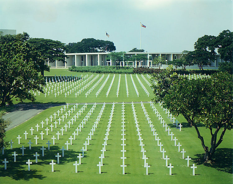
Libingan ng mga bayani. Fort Bonifacio.
Camp O'Donnel (Capas, Tarlac)
Camp O'Donnel (Capas, Tarlac)Established in 1940 as a USAFFE training camp, Camp O’Donnel became known as the Capas Concentration Camp where some 60,500 survivors of the Bataan Death March were incarcerated. Around 30,000 of these prisoners-of-war were dead by 1942. Camp O'Donnell was the final stop of the Bataan Death March and was used as an internment camp for Filipino and American prisoners of war. Around 20,000 Filipinos and 1,600 Americans died at Camp O'Donnell.[1] Filipino and American soldiers were said to have been beheaded in front of open graves. It was liberated by the US Army and Philippine Commonwealth Army on 30 January 1945.The remains of the dead were started to be moved to the Libingan ng mga Bayani and United States Military Cemetery in Fort Bonifacio in 1946.
Reconstructed hut and guard tower
Although La Loma was not a haunted Cemetery, to my belief, there was a time I got stranded after an afternoon play with a classmate. It became a different setting when darkness fell, I felt so alone and just walked fast to get away from the surrounding concrete fence of La Loma.
I have been there in 1953 to 1957 and many stories of the ghost of recent burials and internments were circulating around. The image of a young Japanese artillery officer with a close beard haunted the outside graves. Walking in short pants with his samurai sword slung at his side wearing his soldier’s tunic, or seen sitting alone smoking. The description is aptly backed, by the presence of canons, field pieces in the cemetery. He just walks up to visitors and usually asks for a light. Many startled mourners say he will attend a funeral and walk up at the end of services tap you on the shoulder ask for a light. Simply it has been said that, you turn and he's not there.
Camp O'Donnel (Capas Tarlac). the American sector of the war memorial.
The Cement Cross
In wishing to honor our comrades who died so far away from home the battling bastards of Bataan Death March commissioned the construction of this Replica of the “Cement Cross” in the hope that all those who may pass by to view this memorial will remember the many young Americans who gave their lives in defense of their country and of the Philippines.
In June of 1942 the Japanese authorities at the American side of the Prisoner of war enclosure at Camp O” Donnell, two kilometers north of this site presented the prisoners with some Cement. The American Prisoners decided to build a Cement Cross to honor the memory of their dead comrades. Completed later that month. The cross remained hidden amidst tall grass until was discovered by returning American Forces in 1945. Left where it originally stood unknown to most and battered by the elements. The cross was again forgotten. Rediscovered by Bataan Veterans visiting the area in 1961. The cross became the historical symbol of the American Prisoner of war enclosure and its dead. When American military presence ended in the Philippines in 1992. The cross was brought to the National Historic Site Andersonville, Georgia, USA. Where it is now kept and displayed. This Replica stand as a reminder of America’s unprepared ness before the outbreak of World War II.
Libingan ng mga BAYANI
Coast Guard At Port Area Manila left photo, La loma Cemetery next above, Libingan ng mga Bayani (heroes cemetery) Fort Bonifacio close to where we live at the Navy Village, Fort William McKinley then (Fort Bonifacio)
It was the final stage of the tragic death march and a concentration camp with an open field which served as the dumping grave site of Filipino and American soldiers who died with debilitating diseases. It has witnessed the endless sufferings of the sick and the neglected only to die, then dropped in mass with three and half feet depth and those who survived the darkest moments of their lives, they narrated with tears clouding their eyes, the traumatic experiences encountered during their detention, as they gasped with depression and sadness and said CAMP O” Donnell, that was.
Camp O'Donnel (Capas Tarlac). the American sector of the war memorial.
Bataan Death March Box Car
In San Fernando the POW’s where loaded on the trains bound for Capas, Tarlac, The Boxcars normally carried 50 persons, but the Japanese packed them up 100 to 115 Prisoners. At each stop, The Boxcars were open to give the Prisoners fresh Air. The POW’s got off the train at Capas and marched the final kilometer to Camp O” Donnell.
Escolta 1953-Insular Life bldg in the background
Coast Guard Cutter in the Port Area, similar to ships we used to patrol offshore.
Remnants of Daniel Burnham's stamp in Manila - the old Dewey Blvd. - now Roxas Blvd. Driving through the boulevard feels like driving through Chicago's Lake Shore Drive ... This picture of the boulevard feels like it was taken from a highrise on Chicago's Lake Shore Drive near Goethe and Inner Drive. The US Embassy is situated along this boulevard around the area of the lights jutting into the bay.
Remnants of Daniel Burnham's stamp in Manila - the old Dewey Blvd. - now Roxas Blvd. Driving through the boulevard feels like driving through Chicago's Lake Shore Drive ... Actually Burnham designed plans for Manila (1905) before he designed Chicago (1909). Parts of the design, based on the City Beautiful movement were implemented - like this boulevard along Manila Bay. He also designed Baguio City, the summer capital of the Philippines, situated up in the mountains of Northern Philippines.
On the foreground (right bottom) is one of the American colonial style buildings in the city of Manila ... that was a part of Daniel Burnham's plan for the Manila and most probably designed by Burnham's proteges. (This may be the old Finance Bldg.)
Escolta, Bergs on your right, Lyric movie theater further out to the right. Lyric Theater- a theater house that I used to get in and watch Splendor in the Grass, From Moment to Moment located in Escolta, Manila. It was owned and operated by Eastern Theatrical, Inc. At the far end of Escolta is one of the most beautiful streetscapes in the city with two breathtaking pre-World War II buildings facing each other: the Regina Building and the Perez-Samanillo.
Historic Quezon City. Manuel Quezon's burial monument located at Quezon City Circle, Quezon City, Philippines. Left Photo
Espirito Santo Church
The place where the parish church of Espiritu Santo stands now was an old cemetery, officially closed by the Sanitary authorities already in 1913 due to the growing population in the vicinity. (There was a tree that served as an improvised belfry; on its branch hanged a bell. The two young seminarians studying at CTS, Juan Tugadi and Tomas Pacano, used to climb it to ring the bell. The two later became SVD priests.)
In January 1926, Archbishop Michael O.Doherty of Manila blessed the place where a church dedicated to the Holy Spirit was soon to rise. His Excellency gave a substantial donation for the construction of the church in the amount of P20,000.00. In 1928 our SVD missionaries started the construction of a church building. When Fr. William Finnemann was consecrated Auxiliary Bishop of Manila in 1929, Fr. Philip Beck took over as parish priest in December of 1931 - to him fell the burden of continuing the construction of the church. A crypt which contained 444 niches was built underneath the altar. The niches were sold to local residents and the proceeds used for the completion of the church. After much sacrifice and support from generous benefactors, parishioners and friends, the church was finally finished. It was blessed on the occasion of the parish fiesta on May 14, 1932 by Bishop William Finnemann himself - the first parish priest of Espiritu Santo Church.
February 9, 1946, the Capuchins obtained the official authorization from the government to restore the church of Lourdes in Intramuros. An official letter indicating the approval of the church and its condition, a plan of the church building was approved and signed on February 17, 1946. However, the Capuchins decided to build a beautiful and wide church in Quezon City, Retiro St. because Intramuros was a deserted place, abandoned by people and nobody’s land. The property of Intramuros where the Church of Lourdes and the Central House was sold to support the building of the new church at Quezon City. Feast Day of Our Lady of Lourdes 1946 (Sta. Teresita Parish)
Altar at Our Lady of Lourdes retiro , Q.C
One cannot mention the devotion to Our Lady of Lourdesin the Philippines without citing the people behind the devotion. It was a layman Don Regino Garcia who ordered the Filipino sculptor Manuel Flores to make a statue of Our Lady of Lourdes, which was placed at the side altar of the church of the Capuchins in 1892. March of the same year, the capuchins with the help of Fr. Mc Carthy, an Augustinian priest, brought the image of Lourdes to the University of Santo Tomas. During Palm Sunday of the same year, the image of saints are covered with veils by the Dominicans including the image of Lourdes and handed it over to the Capuchins and carried it to the chapel of Santa Teresita for the celebration of Flores de Mayo.
It was during the Novena at Our Lady of Lourdes when the Japanese ordered all residents of Intramuros to go out of their houses and gather together at the four (4) main places of Intramuros: the Hollywood Theater, the San Agustin Church, the San Francisco Church and the Cathedral. Our Virgin of Lourdes and all the most necessary things were transferred from to altar to the receiving room of the convent of San Agustin Church. On February 11, the Feast of the Virgin of Lourdes, the capuchins and devotees appealed to the Japanese for permission to say 3 masses in the sacristy. The permit was granted, allowing 3 Superiors celebrating 3 masses for the feast: Franciscans, Augustinians and the Capuchins. How was the image of Lourdes was saved during the war?
Many people especially the devotees of Lourdes cried out to the capuchins to see the beautiful Virgin of Lourdes wondering how it was saved. According to history, when the capuchin brothers abandoned the church of Lourdes, Intramuros and the central house, they carried with them the image of Lourdes. Some days later, the Capuchin Custos, ,Fr. Florencio of Lezaun, gathered all religious articles: chalices, ciboriums, monstrances, relics and the treasure of the Virgin of Lourdes: crowns, rosaries and jewels. All together they put in iron box at the bank of D. Raimundo Salonga in Binondo. For the refuge of the Capuchin brothers, they were ordered by their superior to go to San Agustin and placed the images of Lourdes in the wide sacristy of the church. They continued on the daily novena exercises together with the religious of other orders and devotees including Doña Martina Azucena who was miraculously cured in 1896 before the image of Our Lady of Lourdes. On February 23 of the same year, the image of Lourdes was abandoned in the sacristy of St. Augustine. Men young and old and the religious were horribly massacred by the Japanese sometime between January 5-19. Around 3500 women and children and all other refugees of St. Augustine were ordered to abandon the building.
Lourdes Church FacadeOL of Lourdes Fiesta 2010, OL of Lourdes Shrine, Amoranto Ave., Q.C., Philippines
Portal to Old San Lazaro Hospital RuinsShrine of St. Lazarus, Avenida Rizal cor. Tayuman, Manila, Philippines
San Beda Church (Manila) A Swedish architect, George Asp, designed the church that was completed in 1925. Fr. Peter Celestine Gusi (OSB) later added the side chapels and galleries between 1947 and 1958
San Beda Church (Manila)The church is reknowned for its paintings that were done by Fr. Lesmes Lopez (OSB) and Bro. Salvador Alberich (OSB) from 1930 until 1939.
Right PhotoSan Beda Church (Manila) A closer view of the main altar.
Old San Lazaro Hospital Ruins. Shrine of St. Lazarus, Avenida Rizal cor. Tayuman, Manila.
The Manila Jai Alai Building was a building designed by American architect Welton Becket that functioned as a building for which jai alai games were held.[1] It was built in the Streamline Moderne style in 1940 and survived the Battle of Manila.It was considered one of finest Art Deco buildings in Asia. It was demolished on 2000 upon the orders of the Mayor of ManilaLito Atienza amidst protests, to make way for the Manila Hall of Justice, which was never built
Summer of 1950 sparked the beginning of the Korean War. As a police action the United Nations sent 16 member nations to uphold peace and democracy in South Korea. One of these countries was the Philippines who arrived in September of 1950. Very little is known about the Philippines' participation in the Korean War, let alone the soldiers who fought for democracy. These are their memories, the memories of the Forgotten.
Jai Alai structure on Taft Avenue, photo at the right and below.
Old San Lazaro Hospital Ruins Shrine of St. Lazarus, Avenida Rizal cor. Tayuman, Manila
Paco Park ( Manila). Visita Iglesia during vacation in the Philippines. Paco Park's Chapel of San Pancratius is where the remains of Spanish colonial Governor General Ramon Solano was interred. The park was originally designed by Nicolas Ruiz as a cementery of the Spanish colonial elite. It was built in the later years of the 1700s making it one of the oldest, if not the oldest, cementery in the Philippines. The GOMBURZA martys- Fr. Mariano Gomez, Fr. Jacinto Zamora, and Fr. Jose Burgos- were buried here after their execution in 1872. Twenty-four years later in 1896, the executed Dr. Jose Rizal was also secretly buried in the cemnetery. His remains were later exhumed in 1912 and moved to what his now his grand monument at the Luneta. Interment in the cementery was probihited in 1912 and most of the remains of those who were buried were moved out. The cementery became a national park in 1966.
Paco Park, Manila. A cross now marks the burial site of the GOMBURZA martys inside the park.
Paco Park (Manila) Dr. Jose Rizal was secretly buried in the park after his execution. His remains were later exhumed and interred beneath the Rizal Monument at the Luneta.
San Juan, Metro Manila. Unique to the San Juan church is the massive buttress walls covering its facade. Butress walls are usually the side walls in the case of most Philippine colonial churches.
San Juan, Metro Manila. The Dominicans built the first parochial buildings in 1602 that were razed during the 1639 Chinese revolt. These were rebuilt in 1641, burned down during the British invasion of 1763, and rebuilt again in 1774. The city of San Juan is unofficially the "Town of Philippine Presidents" having had 5 Filipino presidents as residents namely Diosdado Macapagal and his unpopular daughter Gloria Macapagal-Arroyo, Ferdinand Marcos, Joseph Estrada, and Elpidio Quirino.
San Miguel, Manila. The Jesuits probably built the first parochial structures during their administration of the San Miguel ecclesiastical district in 1603 until 1768. The Franciscans took over the mission in 1777 and in 1835, Fr. Esteban Mena (OFM) was reported to have started building a church. Fr. Francisco Febres (OFM) made repairs and improvements after the 1852 earthquake. The church was destroyed during the 1880 earthquake and rebuilt by Fr. Emilio Gago (OFM) in 1886. It was rebuilt IN 1913 through the patronage of the Roxas clan and was sedignated by Msgr. Michael O’Doherty as a Pro-cathedral of the Archdiocese of Manila after it was inaugurated in 1913.
Paco Church, Manila. The Franciscans built the first parochial buildings of light materials in 1580 that was probably rebuilt with stronger materials in 1599 by Fr. Juan de Garrovillas (OFM). This was burned down during the Chinese uprising of 1603, rebuilt, burned down again by the invading British in 1762, and replaced with a temporary structure in 1791. Fr. Joaquin Segui (OFM) who built a stone convent in 1793 probably built another church. A new stone church was started to be built by Fr. Bernardo dela Concepcion (OFM) in 1809 while Fr. Miguel Richar (OFM) added a bell tower in 1839. The church was probably damaged during the 1852 earthquake, repaired, then destroyed during another earthquake in 1880. Fr. Gilberto Martin started rebuilding the church in 1881 that was partly destroyed by a typhoon in 1892 before being completed 1896. This was razed during the Filipino-American War and, in 1909, a temporary church was built beside the ruins of the old one by the Belgian missionary Fr. Raymundo Esquinet of the Congregatio Immaculatie Cordis Mariae (CICM). The present church was started to be built by Fr. Godofredo Aldenhuijsen (CICM) in 1931 based on the proposal of Fr. Jose Billie (CICM). It was damaged during World War II and repaired in 1948.
San Lazaro Leisure Park Race Track
San Lazaro Leisure Park Race
The Jesuits built the first Roman Catholic Church in the area where the present Santa Cruz Parish stands on June 20, 1619. The Jesuits enshrined the image of the Our Lady of The Pillar in 1643 to serve the pre-dominantly Chinese residents in the area. The image drew a lot of devotees and a popular cult grew around it. On June 24, 1784, the King of Spain gave the deeds to about 2 km² of land that was part of the Hacienda de Mayhaligue to the San Lazaro Hospital which served as a caring home for lepers in Manila at that time. At the Santa Cruz Parish, a small park was built that linked the area into the headquarters of the Spanish cavalry, the building that once was the College of San Ildefonso, operated by the Jesuits. The district in the Spanish times also had a slaughter house and a meat market and up north was the Chinese cemetery. The Franciscan fathers were given the responsibility to care for the lepers of the city and specifically the San Lazaro Hospital. A Fr. Felix Huertas developed San Lazaro into a refuge for the afflicted and it became a famous home for those afflicted in the north side of the Pasig River.
My first car a 1947 Lincoln 76H Sedan with it's 292c.i. 2BBL 125 H.P. Flat Head V-12, 3 Speed Manual Transmission, Stock Rear Axle & Gear Ratio. The video above is the same as my first car. Like any boys yearning to have his wheels and freedom, I learned to drive at the age of 14 barely reaching the gas pedal and my head above the dashboard. Later I bought the car from my father at the measly sum of 100 pesos.
The Philippine General Hospital located on Taft Avenue beside my High School at Padre Faura was a public hospital but regardless was fortified by the Japanese in violation of the Geneva Convention. Inside there were many Filipino patients and several thousand Filipino refugees that were seeking what they thought would be safe shelter. On the roof on both ends there were large white circles with large red crosses. From Feb. 14 to Feb. 17, 1945 the Americans shelled the area. Some of the shells hit the buildings and many innocent Filipinos were injured and many lives were lost. Notice that the right end of the building was hit with an exploding shell. And notice a hole through the roof on the left end of the building in the white circle area close to the red cross where a shell hit but did not explode.
Tutuban Railroad Station The construction of a railway line traversing the island of Luzon was initiated according to a plan submitted by Don Eduardo Lopez Navarro, then head of the Public Works Office. The line stretches from Tondo, Manila to Dagupan, Pangasinan. On July 31, 1887, the cornerstone of the Tutuban Station was laid by General Emilio Terrero, marking the start of the railroad track.
When the PNR began its operations on November 24, 1892, Tutuban Station became a place of business. It opened its doors to businessmen coming from different parts of Manila. Commerce played a large role in awareness about Tutuban, and it served as an important trading complex due to its very strategic location in Divisoria. Produce coming in by bulk from several provinces are unloaded in the station, and then distributed to retailers awaiting at the station.
The etymology for the name “Tutuban” was believed to have come from the sounds made by the locomotives stationed in the area. However, the word actually comes from “tuba,” the name of the local alcoholic drink made from coconuts, since previously Tutuban was the center of production of this beverage. Natives referred to the place as Tubaan ... meaning a place where the "tuba" (native alchoholic beaverage) came from.
Tutuban Station is also famous for being the birthplace of the revolutionary Andres Bonifacio. In commemoration, a monument stands in the current mall's plaza.
Tanay Lighthouse
Jai Alai
San Lazaro Leisure Park Race Track
Hauling Manila hemp fiber to market,
Binondo Church is located in Manila's Chinatown at the western end of Ongpin Street, Binondo. This church was founded by Dominican priests in 1596 to serve their Chinese converts to Christianity. The original building was destroyed by a bombardment by the British in 1762 during their brief occupation of Manila at that time. The current granite church was completed on the same site in 1852 and features an octagonal bell tower which suggests the Chinese culture of the parishioners. Binondo Church was greatly damaged during the Second World War, although fortunately the western facade and the octagonal bell tower survived. Binondo Church is also known as the Minor Basilica of San Lorenzo Ruiz. It was named after the sacristan, San Lorenzo Ruiz, who was born of a Chinese father and a Filipino mother, trained in this church and afterwards went as a missionary to Japan and was executed there for refusing to renounce his religion. San Lorenzo Ruiz was to be the Philippines' first saint and he was canonized in 1989. A large statue of the martyr stands in front of the church. Masses are held in Filipino, in Chinese dialects (Mandarin, Hokkien), and in English.
I worked here during my college days at Iwaii & CO. Bank of the Philippine Islands at Don Roman Santos Building (a neo-classical, Graeco-Roman architecture at Plaza Goiti (now Plaza Lacson) in Sta. Cruz. Old Tutuban Railway Station
Tanay, lake meets the mountain
Sampaloc, Tanay My Grandfather’s Homestead sold for a measly sum gave me a strong lesson about the intrinsic value of land. Moral lesson gained….Accumulate and never to sell unless to exchange for a bigger valuable parcel.
Sampaloc, Tanay. Tanay is the town of my birth, a first class municipality in the province of Rizal, Philippines. It is located 57 kilometres (35 mi) east of Manila, although a typical commute between Manila and Tanay will take between one to three hours depending upon traffic conditions. It contains portions of the Sierra Madre Mountains and is bordered by Antipolo City in the northwest, Baras, Morong and Teresa in the west, General Nakar (Quezon Province) in the east, and Pililla, Santa Maria (Laguna province) as well as the lake Laguna de Bay in the south. According to the latest census, it has a population of 94,460 people in 15,720 households. The majority of the population consists of Tagalogs who live near Laguna de Bay, though there is also a significant percentage of mountain dwelling people living in the northern portions of the municipality. The town's major trades consist of fishing, agriculture and regional commerce. Tanay is also believed to be the birthplace of the Sambal language and myself too.
Tanay Church in Rizal
h.
This is the only restaurant that can compete with Auntie Auroring’s
pancit mami Manila Harbor, and Intramuros, Philippines, early 1960s Notice that this photo was taken before much rebuilding in Intramuros and there is lots of empty land showing just how much of the city was cleared after WWII.
Rizal Hall, University of the Philippines, September 1950. A photo album on the UP Carillon Tower before and after restoration (and with new bells)by the UP Alumni Association in time for the 2008 Centennial of the University of the Philippines.
University of the Philippines at Diliman
The Volcano Taal is one of the Philippines' active volcanoes and has also been regarded as one of the smallest in the world. It's situated in the middle of Lake Taal in Batangas. Perhaps what makes this volcano unique is that a lake has also formed in its main crater, so you can say there's a lake within a lake.
Left Photo. Mayon Volcano, also known as Mount Mayon, is an active stratovolcano in the province of Albay, in the Bicol Region, on the island of Luzon, in the Philippines.It has a perfect cone shape; It was named after a legendary folk Daragang magayon. It was among the 7 wonders of nature in the Philippines.
1
Jones Bridge, Probably one of the most romantic bridges in the Philippines because of the stories it can tell about Manila as it crosses towards enchanting Chinatown and the once legendary business district. Built in honor of the American politician that passed a bill trying to grant independence to the Philippines during the 1920's.
……………
University of Sto. Tomas is the oldest school in the Philippines. It was founded in 1611 and prides itself to be even older than Harvard.
Plaza Moraga
This is the town of my birth. Long before the coming of Spaniards, Tanay was already settled by early Indonesian and Malay voyagers. Artifacts dug up attest to the existence of these early settlements. Not long after the conquest and subjugation of Manila and the surrounding lake areas by Salcedo in 1571,Franciscan missionaries arrived to Christianize the inhabitants of what is now the Morong-Pililla area. From Morongan, the priest administered Tanay and other chapel villages and ranches. Pila and adjacent towns along the shores of Laguna de Bay are considered by archaeologists as one of the oldest settlements in the Philippines. The community is one of three such concentrations of population known archaeologically to have been in place before A.D. 1000. Archaeologists recovered in Pinagbayanan potteries and artifacts that indicate considerable settlement in the area during the Late Tang Dynasty (900 A.D.). Archaeologists also recovered ancient horse bones ending the debate on whether the Spaniards brought them or not. The scientists were able to uncover Philippines’ oldest crematorium in the same area. It is worthwhile to note that the oldest Philippine document, the 900 A.D. Laguna Copperplate Inscription, mentioned Pila twice.
Farewell, dear Fatherland, clime of the sun caress'd Pearl of the Orient seas, our Eden lost!, Gladly now I go to give thee this faded life's best, And were it brighter, fresher, or more blest Still would I give it thee, nor count the cost.
On the field of battle, 'mid the frenzy of fight, Others have given their lives, without doubt or heed; The place matters not-cypress or laurel or lily white, Scaffold or open plain, combat or martyrdom's plight, T is ever the same, to serve our home and country's need.
I die just when I see the dawn break, Through the gloom of night, to herald the day; And if color is lacking my blood thou shalt take, Pour'd out at need for thy dear sake To dye with its crimson the waking ray.
My dreams, when life first opened to me, My dreams, when the hopes of youth beat high, Were to see thy lov'd face, O gem of the Orient sea From gloom and grief, from care and sorrow free; No blush on thy brow, no tear in thine eye.
Dream of my life, my living and burning desire, All hail ! cries the soul that is now to take flight; All hail ! And sweet it is for thee to expire ; To die for thy sake, that thou mayst aspire; And sleep in thy bosom eternity's long night.
If over my grave some day thou seest grow, In the grassy sod, a humble flower, Draw it to thy lips and kiss my soul so, While I may feel on my brow in the cold tomb below The touch of thy tenderness, thy breath's warm power.
Let the moon beam over me soft and serene, Let the dawn shed over me its radiant flashes, Let the wind with sad lament over me keen ;
And if on my cross a bird should be seen, Let it trill there its hymn of peace to my ashes.
Let the sun draw the vapors up to the sky, And heavenward in purity bear my tardy protest Let some kind soul o 'er my untimely fate sigh, And in the still evening a prayer be lifted on high From thee, 0 my country, that in God I may rest.
Pray for all those that hapless have died, For all who have suffered the unmeasur'd pain; For our mothers that bitterly their woes have cried, For widows and orphans, for captives by torture tried And then for thyself that redemption thou mayst gain.
And when the dark night wraps the graveyard around With only the dead in their vigil to see Break not my repose or the mystery profound And perchance thou mayst hear a sad hymn resound 'T is I, O my country, raising a song unto thee.
And even my grave is remembered no more Unmark'd by never a cross nor a stone Let the plow sweep through it, the spade turn it o'er That my ashes may carpet earthly floor,
Before into nothingness at last they are blown.
Then will oblivion bring to me no care As over thy vales and plains I sweep; Throbbing and cleansed in thy space and air With color and light, with song and lament I fare,
Ever repeating the faith that I keep.
My Fatherland ador'd, that sadness to my sorrow lends
Beloved Filipinas, hear now my last good-by! I give thee all: parents and kindred and friends
For I go where no slave before the oppressor bends, Where faith can never kill, and God reigns e'er on high!
Farewell to you all, from my soul torn away, Friends of my childhood in the home dispossessed ! Give thanks that I rest from the wearisome day ! Farewell to thee, too, sweet friend that lightened my way; Beloved creatures all, farewell! In death there is rest !
Rizal Park, Ermita. At the centre of it all is the 1913 bronze Rizal's monument situated a few metres away from the marker indicating the actual execution site. An honor guard is on duty 24 hours a day. Behind the monument, the original Spanish version of the poem "Mi Ultimo Adios" is engraved, along with translations in other languages. Rizal wrote this poem while imprisoned in his cell in Fort Santiago from November 3, 1896 to December 29, 1896. Many national dedication days are held in front of the Rizal monument. It is also where foreign leaders attend wreath-laying ceremonies during state visits. Located on the monument is the statue of the national hero, but also his remains. On September 28, 1901, the United States Philippine Commission approved Act No. 243, which would erect a monument in Luneta to commemorate the memory of Jose Rizal, Philippine patriot, writer and poet. The committee formed by the act held an international design competition between 1905–1907 and invited sculptors from Europe and the United States to submit entries with an estimated cost of 100,000 peso’s using local materials.
Monte de Piedad Building in Sta. Cruz.
One of the older buildings in the Sta. Cruz area is the quite inconspicuous building of Monte de Piedad. It is just beside the Filipino Chinese Friendship arch at the end of Ongpin Street in Sta. Cruz district. Monte de Piedad is considered as the Philippines first savings bank having been established in 1882. The bank was established to cater to the financial needs of the poor. What’s more, the Catholic Church of the Philippines had strong ties to this bank, in fact the chairman of the board is usually the Archbishop of Manila.
Taken from Fort Santaigo, Fort Santiago is a citadel first built by Spanish conquistador, Miguel López de Legazpi for the new established city of Manila in the Philippines. The defence fortress is part of the structures of the walled city of Manila called Intramuros ( within the walls ). The fort is one of the most important historical sites in Manila. Several lives were lost in its prisons during the Spanish Colonial Period and World War II. José Rizal, the Philippines' national hero, was imprisoned here before his execution in 1896. The Rizal Shrine museum displays memorabilia of the hero in their collection and the fort features, embedded onto the ground in bronze, his footsteps representing his final walk from his cell to the location of the actual execution. The fort was named after Saint James the Great ( Santiago in Spanish ), the patron saint of Spain, whose relief adorns the facade of the front gate. It is located at the mouth of the Pasig River and served as the premier defence fortress of the Spanish Government during their rule of the country. It became a main fort for the spice trade to the Americas and Europe for 333 years. The Manila Galleon trade to Acapulco, Mexico began from the Fuerza de Santiago.
The fort has a perimeter of 2,030 feet ( 620 m ), and it is of a nearly triangular form. The south front, which looks toward the city, is a curtain with a terreplein, flanked by two demi-bastions - the Bastion of San Fernando, on the riverside, and the Bastion of San Miguel, by the bay side. A moat connected with the river separates the fort from the city. Near the beginning of the north face, instead of a bastion, a cavalier called Santa Barbara was built with three faces of batteries, one looking seaward over the anchorage place, one facing the entrance, and the third looking upon the river. The latter is united with a tower of the same height as the walls, through which there is a descent to the water battery placed on a semicircular platform, thus completing the triangular form of the fort. The 22-foot ( 6.7 m ) high walls, with a thickness of eight feet ( 2.4 m ) are pierced for the necessary communications. The front gateway facade measures 40 feet ( 12 m ) high being in the south wall and facing the city. The communication with the river and the sea was by an obscure postern gate - the Postigo de la Nuestra Señora del Soledad ( Postern of Our Lady of Solitude ). Inside the fort were guard stations, together with the barracks of the troops of the garrison and quarters of the warden and his subalterns.
Ferry, Pasig river.Makati, Manila,
Also inside the fort were various storehouses, a chapel, the powder magazine, the sentry towers, the cisterns, etc. The location of Fort Santiago was once the site of a palisaded fort, armed with bronze guns, of Rajah Sulaiman, a Muslim chieftain of pre-Hispanic Manila. It was destroyed by maestre de campo ( master-of-camp ) Martin de Goiti who, on arriving in 1570 from Cebu, fought several battles with the Islamic natives. The Spaniards started building Fort Santiago ( Fuerza de Santiago ) after the establishment of the city of Manila under Spanish rule on June 24, 1571, and made Manila the capital of the newly colonized country. The first fort was a structure of palm logs and earth. Most of it was destroyed when the city was invaded by Chinese pirates led by Limahong. Martin de Goiti was killed during the siege. After a fierce conflict, the Spaniards under the leadership of Juan de Salcedo, eventually drove the pirates out to Pangasinan province to the north, and eventually out of the country. The construction of Fort Santiago with hard stone, together with the original fortified walls of Intramuros, began in 1590 and finished in 1593 during the reign of Gomez Perez Dasmariñas. The stones used were volcanic tuff quarried from Guadalupe ( now Gualupe Viejo in Makati ). The fort as Dasmariñas left it consisted of a castellated structure without towers, trapezoidal in trace, its straight grey front projecting into the river mouth. Arches supported an open gun platform above, named the battery of Santa Barbara, the patron saint of all good artillerymen. These arches formed casemates which afforded a lower tier of fire through embrasures. Curtain walls of simplest character, without counter forts or interior buttresses, extended the flanks to a fourth front facing the city.
Manila
Some fruit in baskets.
Atis fruit Annona squamosa (also called sugar-apple, or sweetsop) is a species of Annona native to the tropical Americas and widely grown in El Salvador, India, Pakistan and the Philippines. Its exact native range is unknown due to extensive cultivation, but thought to be in the Caribbean; the species was described from Jamaica.
Tanay San Ildefonso Church
travel - breathtaking 3 (tanay, rizal)
travel - breathtaking 2 (tanay, rizal)
Plaza Sta Cruz. Prior to the arrival of the Spanish conquistadors to the Philippine Islands, the district of Santa Cruz was partly a marshland, patches of greeneries, orchards and partly rice fields. A Spanish expedition in 1581 claimed the territory and awarded to the Society of Jesus or more commonly called the Jesuits
Manila Cathedral
Regina Building. This building is one of the few American Era buildings that remained along Calle Escolta. Regina bldg. right photo.
Roman Santos Building
The Heritage Bells, the bigger one cast in 1832, the other one fifty years later, were once used to signal the start and end of classes at the Ateneo de Manila campuses in Intramuros and Padre Faura St.During my High School days, the basket ball court at Ateneo was always our venue, most probably due to the trees which shaded the court. The Padre Faura campus continued to house the professional schools until 1976. Fr. Francisco Araneta, S.J. was appointed as the Ateneo de Manila's first Filipino Rector in 1958.In 1959, its centennial year, the Ateneo became university.
The Escolta I remember
Plaza Moraga. I remember passing this way before ... I just could not determine if this is the foot of the the Jones Bridge.
Jeepney Surplus US jeep converted into a mini-bus, painted fancy, seats 10 plus driver. Five cents to ride from suburbs to downtown Manila
Houseboats on the Pasig amid Nila plants. Hence the name, Manila is part of the Pacific Ring of Fire and is jostled regularly by earthquakes.
Escolta
Manila Harbor, and Intramuros, Philippines, late 1950s or early 1960s. Notice that this photo was taken before much rebuilding in Intramuros and there is lots of empty land showing just how much of the city was cleared after WWII.
Customs Building, Port Area, Manila
Port Area Manila
Which ever way ...Different kinds of transportation to bring in and bring out people to and from the island of Cebu in the Philippines.
Coast Guard Port Area Manila
End of Day Sun just about to disappear from the horizon. The ship on the foreground is the PMI training ship.
Luzon, Sagada is nestled in a valley at the upper end of the Malitep tributary of the Chico River some one and a half kilometers above sea level in the central Cordillera; enveloped between the main Cordillera Ranges and the Ilocos Range. Mt. Data in the south and Mt. Kalawitan in the southeast pierce the horizon. Mt. Polis, Bessang and Mt. Tirad in the east, and Mt. Sisipitan in the north mark the Mountain Province - Abra boundary.
Kalinga-Apayao Province
The Banaue Rice Terraces (Tagalog: Hagdan-hagdang Palayan ng Banawe) are 2000-year old terraces that were carved into the mountains of Ifugao in the Philippines by ancestors of the indigenous people. The Rice Terraces are commonly referred to by Filipinos as the "Eighth Wonder of the World". It is commonly thought that the terraces were built with minimal equipment, largely by hand. The terraces are located approximately 1500 meters (5000 ft) above sea level and cover 10,360 square kilometers (about 4000 square miles) of mountainside. They are fed by an ancient irrigation system from the rainforests above the terraces. It is said that if the steps are put end to end it would encircle half the globe.
Contrary to popular belief, the Banaue Rice Terraces are not part of the Rice Terraces of the Philippine Cordilleras UNESCO inscription but are declared a National Cultural Treasure as the Ifugao Rice Terraces. Ancient sprawling man-made structures from 2,000 to 6,000 years old, other terraces are found in the provinces of Kalinga, Apayao, Benguet, Mountain Province and Ifugao. But only those in Batad, Bangaan, Mayoyao, Hungduan and Nagacadan, all in Ifugao, are inscribed as a UNESCO World Heritage Site.
battery grudds Corregidor
Eisenhower visit. I was there observing the motorcade as a sophomore at U.P. Prep. Luneta below. This was the Luneta I remember ... I was in my 2nd year High School at the University when "Ike" visited the Philippines. ... of course Ike used to live here before the 2nd WW when Philippines was a Commonwealth of the United States and was aid to the Field Marshal ...now President of the USA.
Funeral practices and burial customs in the Philippines encompass a wide range of personal, cultural, and traditional beliefs and practices which Filipinos observe in relation to bereavement, dying, honoring, respecting, interring, and remembering their departed loved ones, relatives, and friends. Sources of the various practices include religious teachings, vestiges of colonialism, and regional variations on these.
In the past and in present times, Filipinos believe in the afterlife and give attention to respecting and paying homage to dead people. Wakes are generally held from 3 to 7 days. Provincial wakes are usually held in the home, while city dwellers typically display their dead at a funeral home. Apart from spreading the news about someone’s death verbally, obituaries are also published in newspapers. Although the majority of the Filipino people are Christians, they have retained superstitious beliefs concerning death.
Hanging coffins are coffins which have been placed on cliffs. They can be found in various locations, including China and the Philippines. In China, they are known as Xuanguan which also means "hanging coffin".
Kalinga (Tagalog pronunciation: [kɐˈliŋɐ]) is a landlocked province of the Philippines in the Cordillera Administrative Region in Luzon. Its capital is Tabuk and borders Mountain Province to the south, Abra to the west, Isabela to the east, Cagayan to the northeast, and Apayao to the north.
- Sagada
BanaueLuzon Kalinga-Apayao Provinc Kalinga (Tagalog pronunciation: [kɐˈliŋɐ]) is a landlocked province of the Philippines in the Cordillera Administrative Region in Luzon. Its capital is Tabuk and borders Mountain Province to the south, Abra to the west, Isabela to the east, Cagayan to the northeast, and Apayao to the north. Prior to 1995, Kalinga and Apayao used to be a single province named Kalinga-Apayao, until an ethnic/tribal war prompted separation
Ifugao kids Ang mga Igorot ay isang grupong etniko sa Pilipinas. Matatagpuan sila sa Cordillera, sa isla ng Luzon, sa hilaga ng bansa. Mayroong anim na lalawigan sa Cordillera Administrative Region (CAR): ang Abra, Apayao, Benguet, Ifugao, Kalinga, at Mountain Province. Nag-iisang lungsod sa CAR ang lungsod ng Baguio. May anim na etnolinggwistikong grupo sa parte ng mga pook na tinitirhan ng mga Igorot: ang Bontoc, Ibaloi, Ifugao, Isneg (o Apayao), Kalinga, at Kankanaey. Ang mga Igorot ay kilala sa kanilang pagiging masipag, matatag, at tapat sa kanilang pinagmulan. Mga ugaling hindi basta basta hinahayaang makuha ng iba ang kanilang mga namana o nakuhang mga kayamanan.
Mahalaga sa kanila ang lupa, sapagkat ito ang pangunahing ikinabubuhay nila. Ang isang patunay nito ang Hagdan-hagdang Palayan ng Banawe na matatagpuan sa isang tribu sa Ifugao.
The walk from the road down to the village and back up takes no longer than 1 ½ hours. Much of the walk is through rice fields, so take shelter from sun and rain. The village has become an historic sight, with many traditional houses still standing. Souvenir shops have been set up by the locals and some provide coffee, cold drinks (even beer) and shelter from the rain. We chose hot coffees and were entertained by Conchita at her outdoor tables. We found her conversation so interesting and informative that we stayed for more coffee and finally a beer. I bought one of the excellent knives manufactured by a local blacksmith. He uses steel from old car springs and mounts the pieces in a wooden sheath, bound with rattan, as is the knife handle.
battery crockett
Papa as a young Ensign on training attached to the US Navy
1945-2005-escolta
CHINA TOWN
Manila Quezon Bridge
1
Pre-Hispanic period
Before the first arrival of Europeans on Luzon island, the island was part of the Majapahit empire around the 14th century, according to the epic eulogy poem Nagarakretagama which described its conquest by Mahārāja Hayam Wuruk. The region was invaded around 1485 by Sultan Bolkiah and became a part of the Sultanate of Brunei. The site of Intramuros then became a part of the Islamic Kingdom of Maynila ruled by various Datus, Rajas and the Sultan.
Construction of the defensive walls was started by the Spaniards in the late 16th century to protect the city from foreign invasions. The 0.67-square-kilometre (0.26 sq mi) walled city was originally located along the shores of the Manila Bay, south of the entrance to Pasig River. The reclamations during the early 20th-century obscured the walls from the bay. Guarding the old city is Fort Santiago, its citadel located at the mouth of the river. Intramuros was heavily damaged during the battle to recapture the city from the Japanese Imperial Army during the Second World War. Reconstruction of the walls was started in 1951 when Intramuros was declared a National Historical Monument, which is continued to this day by the Intramuros Administration
Intramuros - Manila Hotel
Intramuros is the oldest district and historic core of Manila, the capital of the Philippines. Known as the Walled City, the original fortified city of Manila was the seat of the Spanish government during the Spanish colonial period. The walled part of Manila was called intramuros, which is Latin for "within the walls"; districts beyond the walls were referred as the extramuros of Manila, meaning "outside the walls"
The Manila Hotel which opened in 1912 and extensively remodeled in the 1970s is a Philippine landmark, home to high society and to political intrigue, and often a scene of historic events.
1898- Judge William Howard Taft issued of the first decrees of the Second Philippine Commission, to create an urban plan for the Manila. Architect and city planner Daniel Hudson Burnham drafted a wide and long tree-lined boulevard that would begin at the park and at the spit’s end of the bay, a boulevard that would be dominated on one end by a hotel.
1908- William Parsons was appointed to continue where Burnham left off. He supervised the design and construction of Manila Hotel and was completed four years later. Soon, a magnificent, white, green-tile-roofed California Missionary-styled edifice emerged housing 149 spacious and high-ceilinged rooms. Since then, it is a hotel that commands the best westward view of Manila’s fabled sunset, the fortress of Corregidor, the poignant ruins of the medieval fortress that was Intramuros, and the palm-lined promenades of Luneta Park.
1
Makati ... the facade of Sanctuario De San Antonio Church in Forbes Park ( Makati, Rizal ). My parish church at Fort Bonifacio back in the 1960s
San Beda College The facade of the Chapel of Our Lady of Montserrat ( San Beda College ) ( Mendiola Street, Manila )...... the primary institution of the Benedictine Order in the Philippines
Altar at Sanctuario de San Antonio, Forbes Park
1960: Pasig River still alive then, now heavy polluted and black in color. The Pasig River was a clear, flowing body of water that served as the center of commerce in Spanish colonial Manila. Stretching 27 kilometers, it connects Laguna Lake to Manila Bay and was the major source of water and livelihood of the many communities along its banks. People washed clothes in the shallower waters and fisher folks’ daily catch were always bountiful. The passenger boats that plied the river from the nearby province of Laguna to Manila and back served as the primary means of transportation. Today’s generation, however, has no recollection of the Pasig River in its heyday. Sunset at Manila Bay where the Pasig Riverempties.
In my late seventies, I begin to see the value of childhood memories, as a legacy worth sharing it to my family and that I, hopefully, will not be forgotten when I leave this physical world.
My consciousness started on a bright November day in 1946 at the age of two. I experienced my new relation with my sister Aleta newly arrived from the hospital the night before. On this early morning, while waking from deep sleep in the bedroom, I saw my mother and the new born baby. I stood up watched my sister take my place as the new “baby” supposed with the jealousy of a child wondering what his new status is.
At a distance I could see my mother's pretty face nourishing my little sister, as I ran toward her. I can only imagine her smiling face filled with assurance to know how I felt, tinge with a fear of rivalry, little legs running toward her.
Right photo, was taken one month before Aleta was born, bottom photo further down taken at graduation from Grade 7, March 17, 1957.
Angeles del Pilar ……..1919-1994
I have always regarded my mother as the most patient, gentle and beautiful person in my life. She was my model during my search for my future wife. As a little child I loved her most of all, now that I am old, my love for her has grown beyond this world. I terribly miss her presence and tender care.
Among cousins in a wedding of Josephine. I am the 3rd boy to the right.
I graduated right in front of this building with class 1966 ChE and Carlos P. Romulo as guest speaker. The Institute is a reputable source of architects, engineers, and science graduates and constantly produces top notchers in the architectural and engineering fields. Photo below of the American Cemetery at the old Fort Bonifacio, where we lived close by.
In 1951, the Mapúa family acquired a piece of land from the La Corporación Fransicana where the present Intramuros Campus stands. The campus opened at 1956 while the building construction were completed in 1963. All college programs were transferred from the Doroteo José campus to the Intramuros Campus in 1973. During my stay, the Institute consistently dominated the top 10 and even the top 20 slots in most licensure exams for architecture and engineering, year after year. It also consistently achieved the highest passing rates in the board exams among other competing schools in architecture and the various fields of engineering.
Chapel Sculpture Facade of the 60-ft tall chapel of the American Cemetery in Fort Bonifacio, Taguig City. The sculpture represents, from bottom to top, the young American warrior symbolized by St George, fighting his enemy, the dragon, in the jungle. Above them are the ideals for which he fought: Liberty, Justice, Country. Columbia, with the child symbolizing the future, stands at the zenith. Information sourced from the Manila American Cemetery and Memorial pamphlet.
High Noon at the Batttlefield
Right hemicycle of the Manila American Cemetery, viewed from the entrance of the left hemicycle. The gap between the gray pebbles is the path to the memorial's chapel. For more information, please see
In Memoriam
Opposites
Shot at the Manila American Cemetery. The brownish smooth hardness of the limestone tablets against the dark, disordered patterns of the tree's foliage. Order and disorder. Life. Gone, and the living.
Wall of the Missing. Continuing with the B&W project. Shot at the Manila American Cemetery in Fort Bonifacio, Taguig City. As the sun gently sinks, the shadows slowly draws across the names of the missing valiant - exactly 36,286 American and Filipino servicemen are recorded in these limestone tablets.
Manila American Cemetery and Memorial
Manila American Cemetery and Memorial is located in Fort Bonifacio, Taguig City in Metro Manila, Philippines.
Manila American Cemetery and Memorial
Nave Chapel of Our Lady of the Miraculous Medal, Philippine Women's University, Manila, Philippines
Pasig River viewed from old Ayala Bridge
Puerta de Isabel Gate through the old Spanish Wall, Intramuros, Manila
Puerta Postigo del Palacio Gate, Intramuros, Manila, Philippines
The awesome interior of old Binondo Church ( Basilica of San Lorenzo Ruiz ) .... the patroness of this historic Dominican Church is the Nuestra Senora Del Rosario . In College, I worked in this building with an export import company.
The cemetery, 152 acres (62 ha) or 615,000 square metres in area, is located on a prominent plateau, visible at a distance from the east, south and west. With a total of 17,206 graves, it is the largest cemetery in the Pacific for U.S. personnel killed during World War II, and also holds war dead from the Philippines and other allied nations. Many of the personnel whose remains are interred or represented were killed in New Guinea, or during the Battle of the Philippines (1941-42) or the Allied recapture of the islands. The headstones are made of marble which are aligned in eleven plots forming a generally circular pattern, set among masses of a wide variety of tropical trees and shrubbery.
The Pontifical and Royal University of Santo Tomas, The Catholic University of the Philippines (colloquially UST or "Ustê". Filipino: Unibersidad ng Santo Tomas), is a private Roman Catholic university run by the Order of Preachers in Manila. Founded on April 28, 1611 by archbishop of Manila Miguel de Benavides, it has the oldest extant university charter in the Philippines and in Asia. and is one of the world's largest Catholic universities in terms of enrollment found on one campus. UST is also the largest university in the city of Manila. Almost all the MD’s of the family graduated from UST.
Centro Escolar University, Manila,
FEU Right Photo
st joseph's college
FEU -
Typical corner cafe and street vendor up front.
My parents married in this church in 1942. The Roman Catholic Church of San Ildefonso, in its eyes, a marriage is forged by God. The Church states that what God joins together, humans cannot sunder. I was also baptized in this church by Father Price, the parish priest on September 10, 1944.
Tanay San Ildefonso Church
Bomod-ok Falls. Sagada, Mt. Province, Philippines
Curvy Road over Mt. Province
Sagada, Mt. Province
Taal Volcano
Pasay City, Roxas Blvd. at Aristocrat (Barbecue Plaza)
Plaza Miranda-Quiapo 1950's-1970's Metro Manila
Quezon Blvd.- Quiapo1950's-1970's Metro Manila,
Rizal Theater-Makati 1950's-1970's Metro Manila, Philippines
Palm Sunday
Benediction every Monday afternoon. Our ritual at Espirito Santo Parochial School
Before I left for the US we visited Tagaytay for the last time. From the ridge, a magnificent view of Taal can be seen, and Taal lake as the picture above can be accessible by car from the main road.
Taal volcano as seen from Picnic Grove on a cloudy day.
Taal Volcano is a complex volcano. Historical eruptions are concentrated on Volcano Island, an island near the middle of Lake Taal. The lake partially fills Taal Caldera, which was formed by powerful prehistoric eruptions between 140,000 to 5,380 BP. Viewed from Tagaytay Ridge, Taal Volcano and Lake presents one of the most picturesque and attractive views in the Philippines. It is located about 50 km ( 31 miles ) south of the capital of the country, the city of Manila. The volcano had several violent eruptions in the past causing loss of life in the island and the populated areas surrounding the lake, with the death toll estimated at around 5,000 to 6,000. Because of its proximity to populated areas and its eruptive history, the volcano was designated a Decade Volcano, worthy of close study to prevent future natural disasters. It is one of the active volcanoes in the Philippines and part of the Pacific ring of fire. Taal Volcano and Lake are wholly located in the province of Batangas. The northern half of Volcano Island falls under the jurisdiction of the lake shore town of Talisay, and the southern half to San Nicolas. The other towns that encircle Taal Lake include Tanauan, Talisay, Laurel, Agoncillo, Santa Teresita, Alitagtag, Cuenca, Lipa, Balete and Mataas na Kahoy.
Main Gate, Intramuros
The site of Intramuros was originally a large Malayan-Islamic settlement named "Maynilad", ruled by three chieftains Rajah Sulayman, Lakan Dula and Rajah Matanda. The name came from "may nilad", "nilad" being a water plant whose star-shaped flowers clustered in abundance along the low-lying riverbanks. The strategic location of Maynilad, being on the Pasig River and the Manila Bay, made it an ideal location for indigenous Tagalog tribes to trade with other Asian civilizations, including Chinese and Islamic merchants who had come from China, Borneo and Indonesia. Maynilad was also the seat of power for native chiefs who ruled the area before Europeans first arrived in Luzon. In 1564, conquistadors led by Miguel López de Legazpi sailed from New Spain (Mexico) and arrived on the island of Cebu in February 13, 1565. There they established the first Spanish colony in the archipelago. Having heard of rich resources of Manila by local natives, López de Legazpi dispatched two of his Lieutenant-commanders, Martín de Goiti and Juan de Salcedo to explore the northern regions of the Visayas. In 1570, the Spaniards arrived in the island of Luzon. After quarrels had erupted between the Islamic natives and the Spaniards; Goiti and López de Legazpi's soldiers waged war on the people, before they were able to take control and establish a permanent settlement in the area. In 1571 after the natives were defeated in battle, López de Legazpi made a peace pact with Rajah Sulayman, Rajah Lakandula and Rajah Matanda; who, in return, handed over Manila to the Spaniards. Citing the rich resources and location of Manila; López de Legazpi declared the area as the new capital of the Spanish colony in the Philippines on June 24, 1571. The King of Spain, delighted at the new conquest achieved by López de Legazpi and his men, awarded the city a coat of arms and declaring it Ciudad Insigne y Siempre Leal ("Distinguished and ever loyal city"). The planning of the city of Manila was commenced by López de Legazpi who had become the first Governor general on the islands. He established forts, roads, churches and schools. The plans for Intramuros were based on King Philip II's Royal Ordinance issued on July 3, 1573 in San Lorenzo, Spain. It's design was based upon a medieval castle structure and covered 64 hectares of land, surrounded by 8 metre thick stones and high walls that rise 22 metres. Intramuros was completed in 1606 and it served as the center of political, military and religious power of the Spaniards during the time that the Philippines was a colony of Spain. Inside Intramuros; there are several Roman Catholic churches, like the Manila Cathedral and the San Agustin Church, convents and church-run schools, such as the Universidad de Santo Tomás, the Colegio de San Juan de Letran and the Ateneo Municipal de Manila, which were usually being run by religious orders such as the Dominicans, Augustinians, Franciscans and Jesuits. The Governor's Palace, the official residence of the Spanish Viceroyalties to the Philippines was originally in Intramuros before it was officially moved to Malacañang Palace and Fort Santiago. Only Spaniards and Mestizos were allowed to take part on political issues and take residence inside the walled city, Christian natives and Chinese were also allowed inside, but Spanish officials prevented them living there. The vast majority of the natives and Chinese residents lived outside the walled city.
This is the view looking from Life Theater across Quezon Boulevard. I used to watch movies at this theater in the 50's
1950’s Children Parties with cousins
Sangley Point Air Base . My father became the CO of Sangley Point Cavite Naval Base in the 70’s. I would be remiss if I do not mention my favorite swimming hole in Tanay, Daranak Falls. Remembering fondly, cherishing memories of early summer vacations spent at this place. This 14-meter high falls is truly a refreshing site. A short walk over the top of Daranak are smaller, cascading streams known as Batlag Falls. It is located at Bgy. Tandang Kutyo in the town of Tanay. The place has been transformed into a public park/resort operated by the government.
Aurora Blvd.-Cubao1950's-1970's Metro Manila,
Old Capitol Movie Theater
Capitol Theatre Art Deco in Escolta, Manila. Capitol used to be one of the finest movie houses in the Philippines until the 1960s.
A smile shines thru. The Philippine Santa Cruzan celebration is held each month of May. It highlights a religious procession participated in by beautiful ladies, among them a "Reyna Elena." They depict the historic search of the Holy Cross by Queen Helena and her son Constantine the Great. Typical corner cafe and street vendor up front
Manila hemp arriving in cart loads at a Manila warehouse
Carabao cart hauling lumber the old energy efficient Filipino way, Manila
Ayuntamiento Building, Intramuros, Manila
Rizal Hall, University of the Philippines
Independent Philippines and the Third Republic (1946-1972). In April 1946, elections were held. Despite the fact that the Democratic Alliance won the election, they were not allowed to take their seats under the pretext that force had been used to manipulate the elections. The United States withdrew its sovereignty over the Philippines on July 4, 1946, as scheduled. Manuel Roxas (Liberal Party), having been inaugurated as President as scheduled, on July 4, 1946 before the granting of independence, strengthened political and economic ties with the United States in the controversial Philippine-US Trade Act, In Mar., 1947, the Philippines and the United States signed a military assistance pact (since renewed) which allowed the US to participate equally in the exploitation of the country's natural resources—and rented sites for 23 military bases to the US for 99 years (a later agreement reduced the period to 25 years beginning 1967). These bases would later be used to launch operations in the areas of Korea, China, Vietnam, and Indonesia. During the Roxas administration, a general amnesty was granted for those who had worked together with the Japanese while at the same time the Huks were declared illegal. His administration ended prematurely when he died of heart attack April 15, 1948 while at the US Air Force Base in Pampanga. Vice President Elpidio Quirino (Liberal Party, henceforth referred to as LP) was sworn in as President after the death of Roxas in April 1948. He ran for election in November 1949 against Jose P. Laurel (Nacionalista Party, henceforth referred to as NP) and won his own four-year term. During this time, the CIA under the leadership of Lt. Col. Edward G. Lansdale was engaged in paramilitary and psychological warfare operations with the goal to hold back the Huk Movement. Among the measures which were undertaken were psyops-campaigns which demoralized the superstition of many Filipinos and acts of violence by government soldiers which were disguised as Huks. By 1950, the U.S. had provided the Philippine military with supplies and equipment worth $200 million dollars. The huge task of reconstructing the war-torn country was complicated by the activities in central Luzon of the Communist-dominated Hukbalahap guerrillas (Huks), who resorted to terror and violence in their efforts to attain land reform and gain political power. They were finally brought under control (1954) after a dynamic attack introduced by the minister of national defense, Ramón Magsaysay. By that time Magsaysay was president of the country, having defeated Quirino in Nov., 1953. His campaign was massively supported by the CIA, both financially and through practical help in discrediting his political enemies. He had promised sweeping economic changes, and he did make progress in land reform, opening new settlements outside crowded Luzon Island. His death in an airplane crash in Mar., 1957, was a serious blow to national morale. Vice President Carlos P. García succeeded him and won a full term as president in the elections of Nov., 1957. In foreign affairs, the Philippines preserved a firm anti-Communist policy and joined the Southeast Asia Treaty Organization in 1954. There were difficulties with the United States over American military installations in the islands, and, in spite of formal recognition (1956) of full Philippine sovereignty over these bases, tensions increased until some of the bases were dismantled (1959) and the 99-year lease period was reduced. The United States rejected Philippine financial claims and projected trade revisions. Philippine opposition to García on issues of government corruption and anti-Americanism led, in June, 1959, to the union of the Liberal and Progressive parties, led by Vice President Diosdado Macapagal, the Liberal party leader, who succeeded García as president in the 1961 elections. Macapagal’s administration was marked by efforts to combat the mounting rise that had plagued the republic since its birth; by attempted alliances with neighboring countries; and by a territorial argument with Britain over North Borneo (later Sabah), which Macapagal claimed had been leased and not sold to the British North Borneo Company in 1878.
Inside the walls of Intramuros, The location of MIT.One of the seven Gates. The construction of Intramuros started in 1571 by Miguel Lopez de Legaspi, a Spaniard. The walled city covers an area of about 160 acres. Intramuros was a fortress city with walls 6 metres high and a commanding 3 kilometres in length, it is no wonder it was impenetrable. Only the Spanish elite and Mestizos (mixed race) were permitted to live inside Intramuros, where at night the city gates were locked down.
intramuros, manila cathedral
The natives and Chinese were not permitted to live inside the walled fortress and were resigned to live outside the great walls of Intramuros. Intramuros was designed with 51 blocks within the vast walls, the only access in or out of Intramuros was via seven fortified gates. A moat around the walled city was added in 1603. Spread throughout the 51 blocks of the city were 12 churches, hospitals, domestic accommodation, military barracks, Governors Palace and schools.
My Church in the town of my birth:Tanay, Built in 1778, the church was named after the Archbishop Ildefonso of Toledo, Spain, who was consecrated during the year 657 AD; revered for his spiritual vitality and deep writings contained in “ The Book of the Virginity of Maria”. Behind the heavy stone edifice decorated with Hispanic, archetype windows and stone sculpture of its saint, are legends that found its way to this generation. Tradition has it that an image of the Lady of the Immaculate Conception, was found among the belongings of our fleeing forefathers on the onset of the Spanish Invasion in 1573; the same image found among the remnants from the fire that gutted the first church in 1620- a lone survivor! During the Chinese Uprising in 1639, Father Geronimo de Frias hid it in the fields but was later on found by the Chinese rebel who tried to destroy the image, instead to themselves befell violent death.
Cross at Bukal, in Tanay
This was always sang to me by my grandmother. Presented in this video are the vintage photographs of the following colonial and historical religious edifices: 1. La Loma Church - formerly Caloocan, now Manila 2. Sto Domingo Church- Intramuros (destroyed by the Americans during world war II) 3. Paco Catholic Cemetery - Paco 4. Tondo Church -Tondo 5. San Sebastian Church -Manila 6. Binondo Church - Binondo 7. San Juan Church - San Juan 8. Sta. Cruz Church - Manila 9. Manila Cathedral - Intramuros 10. Poong Nazareno Church - Quiapo Television was introduced in the Philippines in 1953 with the opening of DZAQ-TV Channel 3 of Alto Broadcasting System in Manila. The station was owned by Antonio Quirino, the brother of the incumbent Philippine president, who was set to run for re-election the following year. The station operated on a four hour-a-day schedule (6 - 10 p.m.) and telecast only over a 50-mile radius. This television station was later bought by the Chronicle Broadcasting Network which started operating radio stations in 1956. CBN was owned by the Lopezes who were into various business concerns. The acquisition signalled the birth of ABS-CBN Broadcasting Network, now considered one of the major broadcasting companies not only in the Philippines but also in Asia. The Lopezes also owned The Manila Chronicle, a leading daily at that time. ABS-CBN therefore became not only the first radio-TV network in the Philippines but also the first cross-media entity owned by a family --- a situation which remains until today. Subsequently, the Lopez group added a second station, DZXL-TV 9. By 1960, a third station was in operation, DZBB-TV Channel 7 or Republic Broadcasting System, owned by Bob Stewart, a long-time American resident in the Philippines , who also started with radio in 1950. The first provincial television stations were established in 1968 in Cebu, Bacolod, and Dagupan by ABS-CBN. The network is supplemented by 20 radio stations located nationwide.
Economic constraints during these early years of television forced a dependence on imported programs from three U.S. networks – ABC, CBS, and NBC. Importing programs was cheaper than producing them locally. In addition, canned programs appeared to be more popular among local audiences, even though initiatives were made in educational programming. The commercial thrust of Philippine broadcasting has made it unique among other East Asian countries, where the electronic media are controlled and operated by the government. While this free enterprise environment made local broadcasting globally competitive, the same environment made it difficult to produce and broadcast public service and "development" oriented programs. Philippine television's early dependence on US programs may be partly responsible for "colonial mentality" that has continued to afflict Filipinos during the past several generations. The commercial orientation of TV also engendered a "that’s entertainment" mentality in both the advertisers and the general public.
Supreme Court Building C/ Padre Faura Ermita, Manila, next above photo was class ‘61 UP Prep Building at the right is Rizal Hall, the location of my University of the Philippines Prep High School.
Photo of Rizal Hall below was taken in 1950.
The Pasig River (called Ilog Pasig in Filipino) is a river that connects Laguna de Bay (via the Napindan Channel) into Manila Bay.
An Old House on Tayabas Street
QUIAPO CHURCH
Tanay plaza
The Philippine Santa Cruzan celebration is held each month of May. It highlights a religious procession participated in by beautiful ladies, among them a "Reyna Elena." They depict the historic search of the Holy Cross by Queen Helena and her son Constantine the Great.
Calle M.H. Del Pilar Nuestra Señora de los Remedios Church C/ M.H. Del Pilar Malate, Manila
Plaza MorionesPlaza Moriones C/ Santa Clara, Fort Santiago Intramuros, Manila
Hanging bridge at the Sierra Madre Inn
into the woods
Fishing is a major industry in my home town. Of course it would make sense since we live by a lake. Laguna Lake is spanish for Lake Lake.
Early 1960:I remember the old beautiful architectural lines of the Manila Hotel, not the new monstrous addition as it is now. it reinforces the fact that much of the loss of the quality of life in the metropolis owes to crass commercialism, slapdash development, and the regulated chaos that makes up for urban planning in the otherwise overly regulated and bureaucratized regime in the Philippines. I reflect the times in High School when we trek on to this site from Padre Faura, Rizal Hall to the US Embassy Canteen to buy our ice cream cone for 10 centavos. Pleasant memories too of my first exposure to teen age westerners on one to one basis in this Hotel at pool side parties. This song jogs the memory lane.
US Embassy Compound, near Rizal Park, Manila, as seen from the Filipinas Hotel. Port of Manila in background. I reflect the times in High School when we trek on to this site from Padre Faura, Rizal Hall to the US Embassy Canteen to buy our ice cream cone for 10 centavos.
US Embassy Manila
Tanay, Rizal
Bomod-ok Falls
Below photo of Sarmiento building on Ayala Ave. Then after, is Roxas Boulevard at twilight. Beyond is the breakwater protecting the harbor basin of the Navy and the Manila Yacht Club. This was the seaside Avenue at the MNS where we lived, the attraction was the sunset across Manila Bay which I took for granted. This truly beautiful sight served a fitting backdrop for the many hundreds of families and lovers who still flock there each evening to enjoy the cool breeze and precious moments together. The garish artificial illuminations of Luneta take over at dusk, but it surely pale in comparison to the grandeur of the setting sun, nature’s own design for Roxas Boulevard, as the sun slowly descends behind the Bataan peninsula.
Ayala Ave Makati: Sarmiento Bldg. (Curvilinear windows) where I used to work at Procter and Gamble PMC on your middle right.
Sarmiento Bldg, Makati, where I worked at Procter & Gamble;
ARISTOCRAT. The closest restaurant to our place at MNS. 432 San Andres St. cor. Roxas Blvd., Malate
Top, movie houses, City Hall,
Right Photo Bagiuo, the terraces and the Lost highway bontoc-mainit (mountain province). A mountain trail in the Cordillera, Philippines.
Rizal Avenue the street was named after Rizal, it was referred to as Calle Dulumbayan. I watched movies at the Ideal, State, Dalisay and Avenue Theaters. Later on ... the Universal Theater and Odeon and Galaxy. And Scala, Apollo, Alegria and Opera House.
In the twilight of age all things seem strange and phantasmal, As between daylight and dark ghost-like the landscape My heart goes back to wander there, And among the dreams of the days that were, I find my lost youth again. And the strange and beautiful song,
The groves are repeating it still: "A boy's will is the wind's will, And the thoughts of youth are long, long thoughts." I should not be withheld but that some day into their vastness I should steal away, Fearless of ever finding open land, or highway where the slow wheel pours the sand...RF
Music is a very important part of every body's life. For some, the tunes represent the milestones, the places, the times and the significant episodes of their existence. It is also said that music is food for the soul that should profoundly inspire us to greater vision, wherefore we soar with the music as we should ....................Amor Patriae


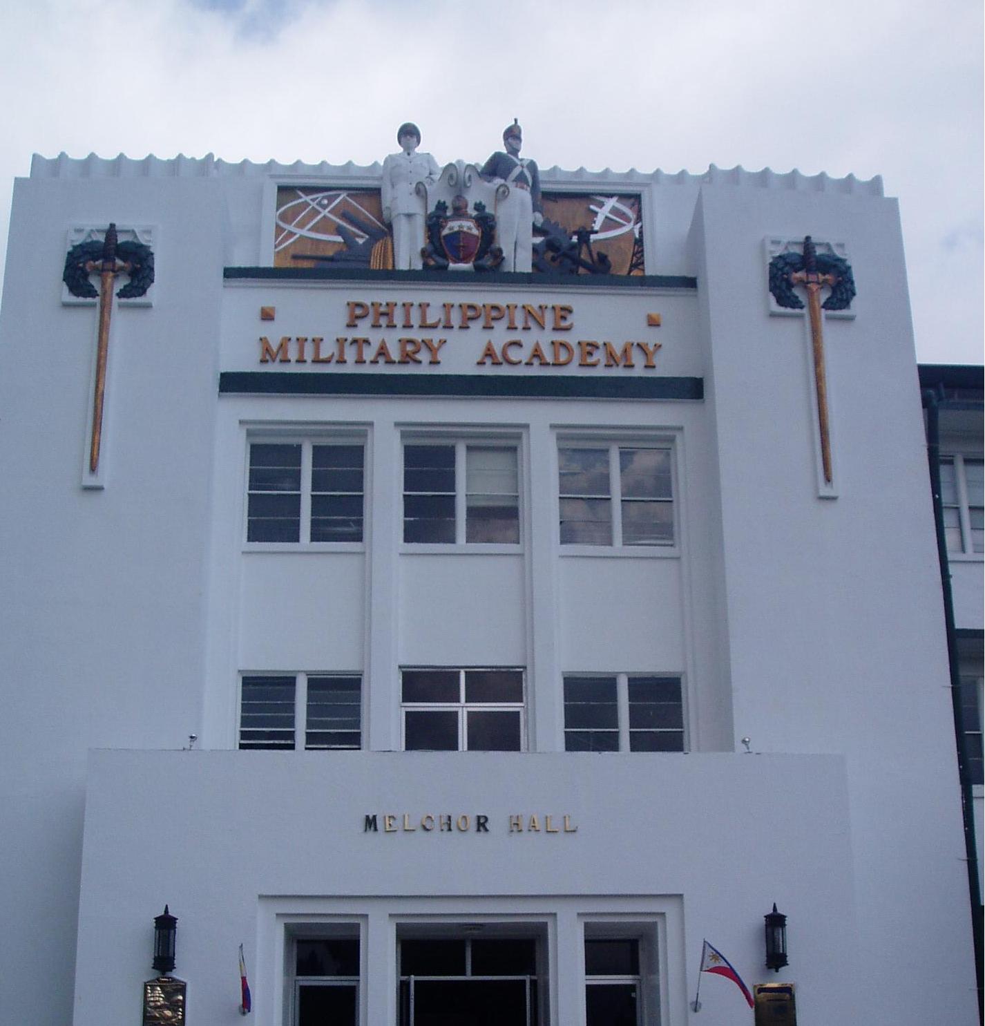


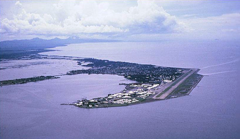


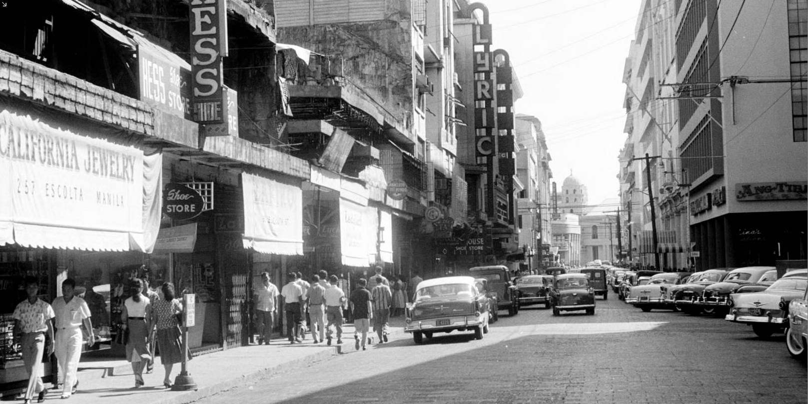
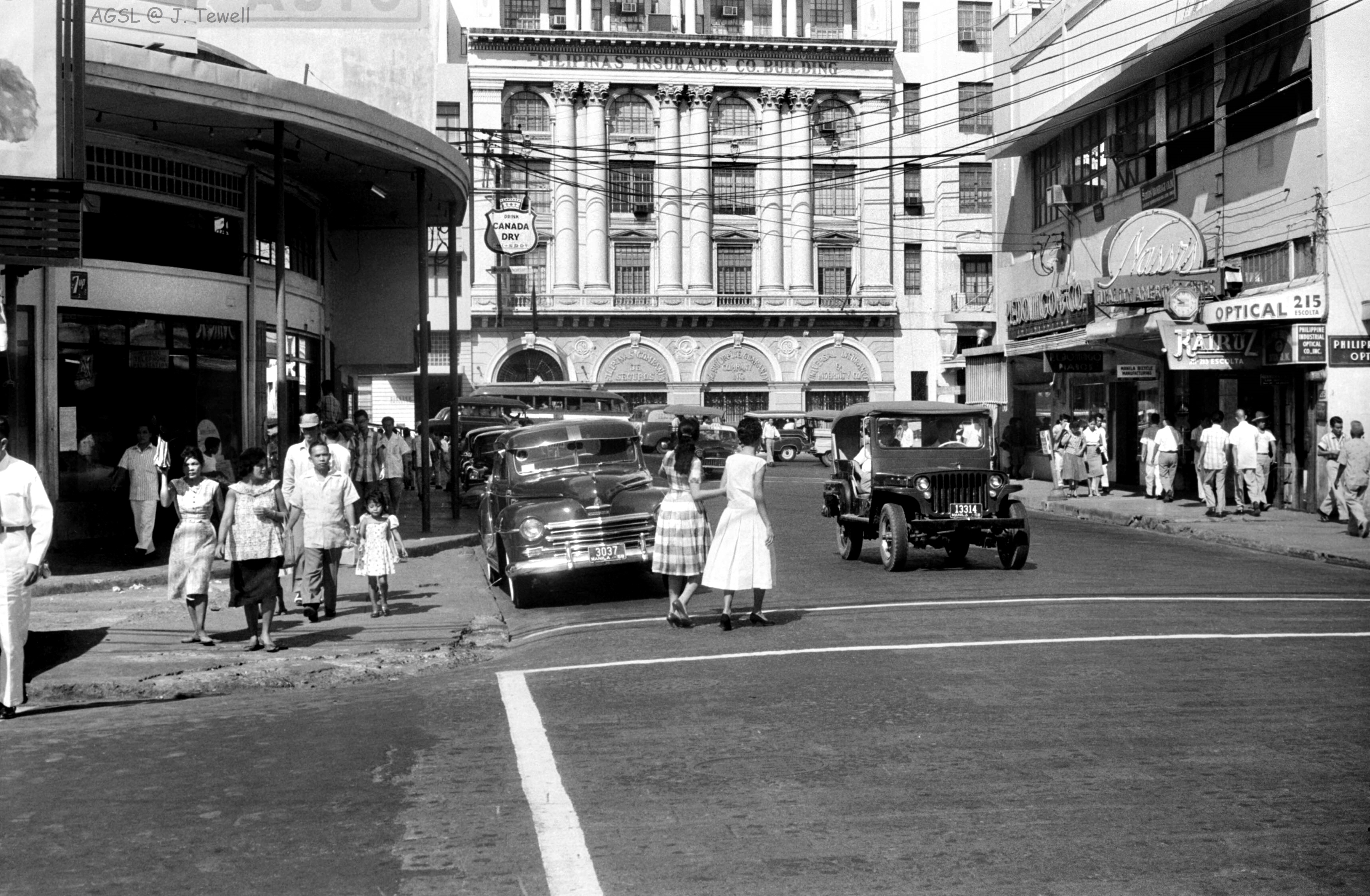


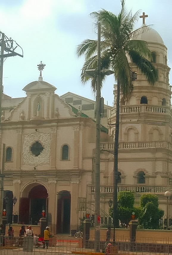


 ……………


 Manila Cathedral


 Eisenhower visit. I was there observing the motorcade as a sophomore at U.P. Prep. Luneta below. This was the Luneta I remember ... I was in my 2nd year High School at the University when "Ike" visited the Philippines. ... of course Ike used to live here before the 2nd WW when Philippines was a Commonwealth of the United States and was aid to the Field Marshal ...now President of the USA.